Interazione con la mappa
Ecco alcune delle possibili interazioni con la mappa in QField.
Legenda della mappa
Lavoro sul campo
Apri il Menù principale ed espandi la lista dei layer per mostrare la legenda della mappa.
Con un doppio tocco o una pressione prolungata su un layer, ti vengono offerte le seguenti possibilità.
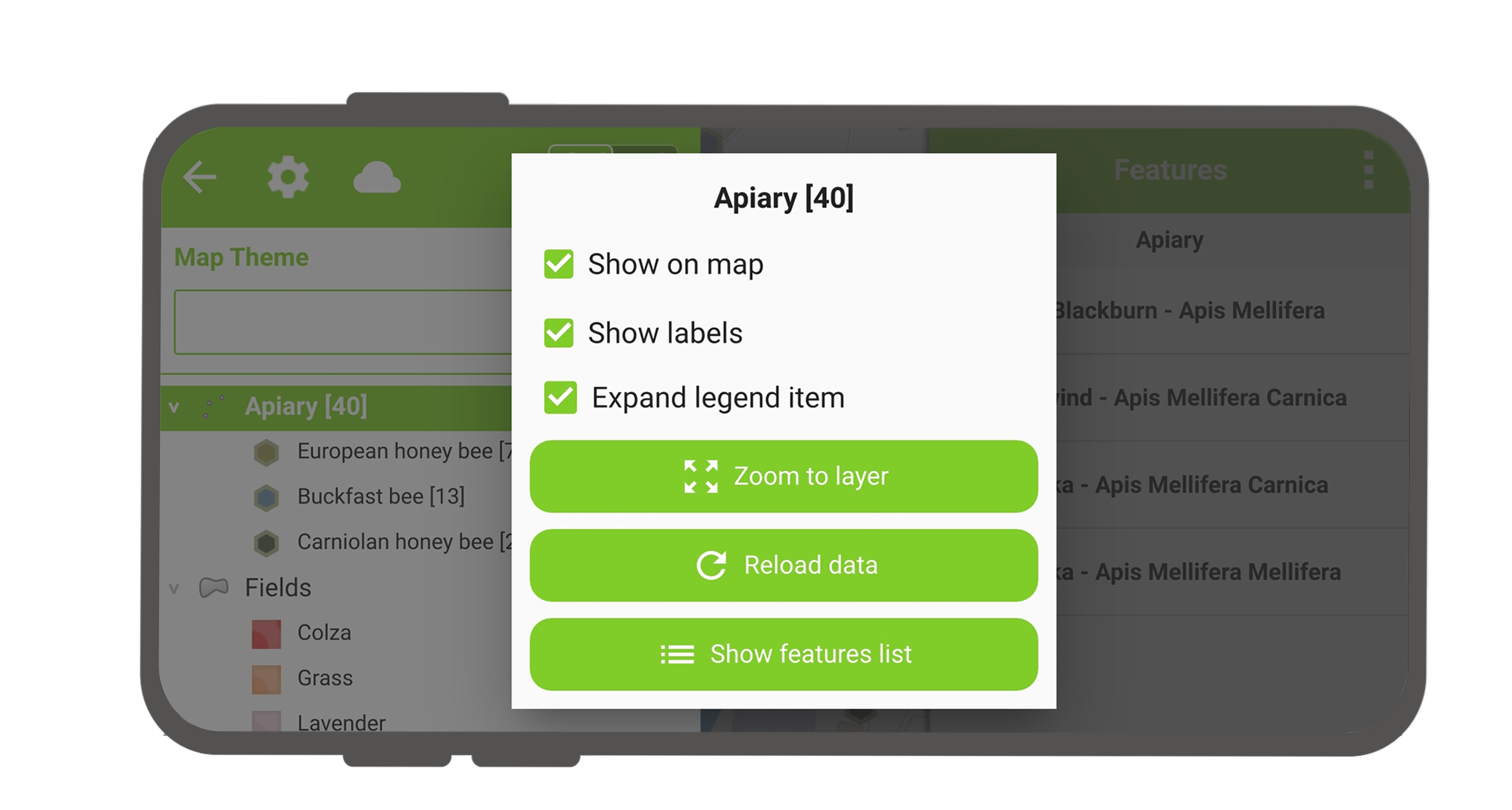
- Espandi elemento per mostrare/nascondere i sotto elementi del layer.
- Mostra sulla mappa per controllare la visibilità.
- Mostra etichette per controllare la visibilità delle etichette.
- Opacity Slider to control the transparency of the layer.
- Zoom to layer per avere tutti gli elementi del layer sulla mappa.
- Reload icon to get the current data of a layer with remote sources.
- Mostra lista elementi per mostrare tutti gli elementi del layer nella lista di identificazione.
- Setup tracking to set up tracking mode of layer.
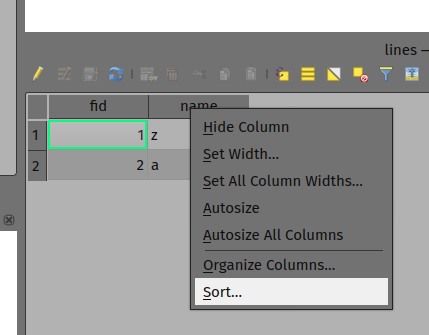
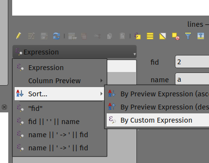
Ordina gli elementi del layer
Preparazione da Desktop
Se si desidera configurare l'ordine degli elementi in 'Mostra lista degli elementi' in QField, si hanno le seguenti opzioni per preconfigurarlo su QGIS:
- Basta fare clic con il tasto destro su qualsiasi parte dell'intestazione di una colonna e selezionare l'opzione 'Ordina' dal menù. Questo ti permette di inserire espressioni di ordinamento complesse per i tuoi elementi come richiesto.
- When being in the form view, you can access the sorting functionality by clicking on the expression button located at the top of the features list and select the 'Sort' option.
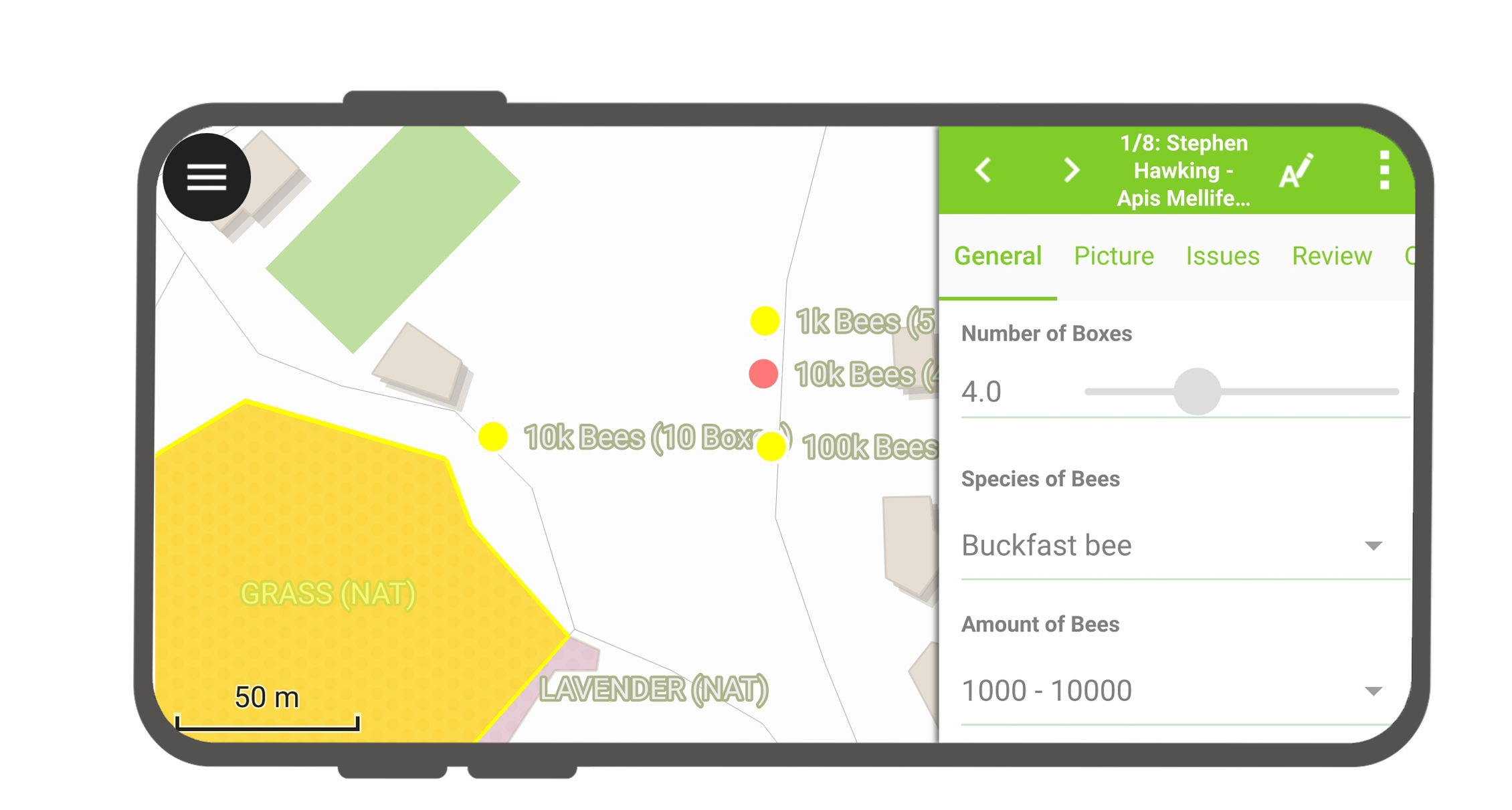
Identificare elementi
Lavoro sul campo
Tap on a feature on the map to identify it. If several features are located where you tapped (either because there are multiple features really close one to another, or because several layers are overlapping), they will all be listed in the menu that opens on the right of the screen.
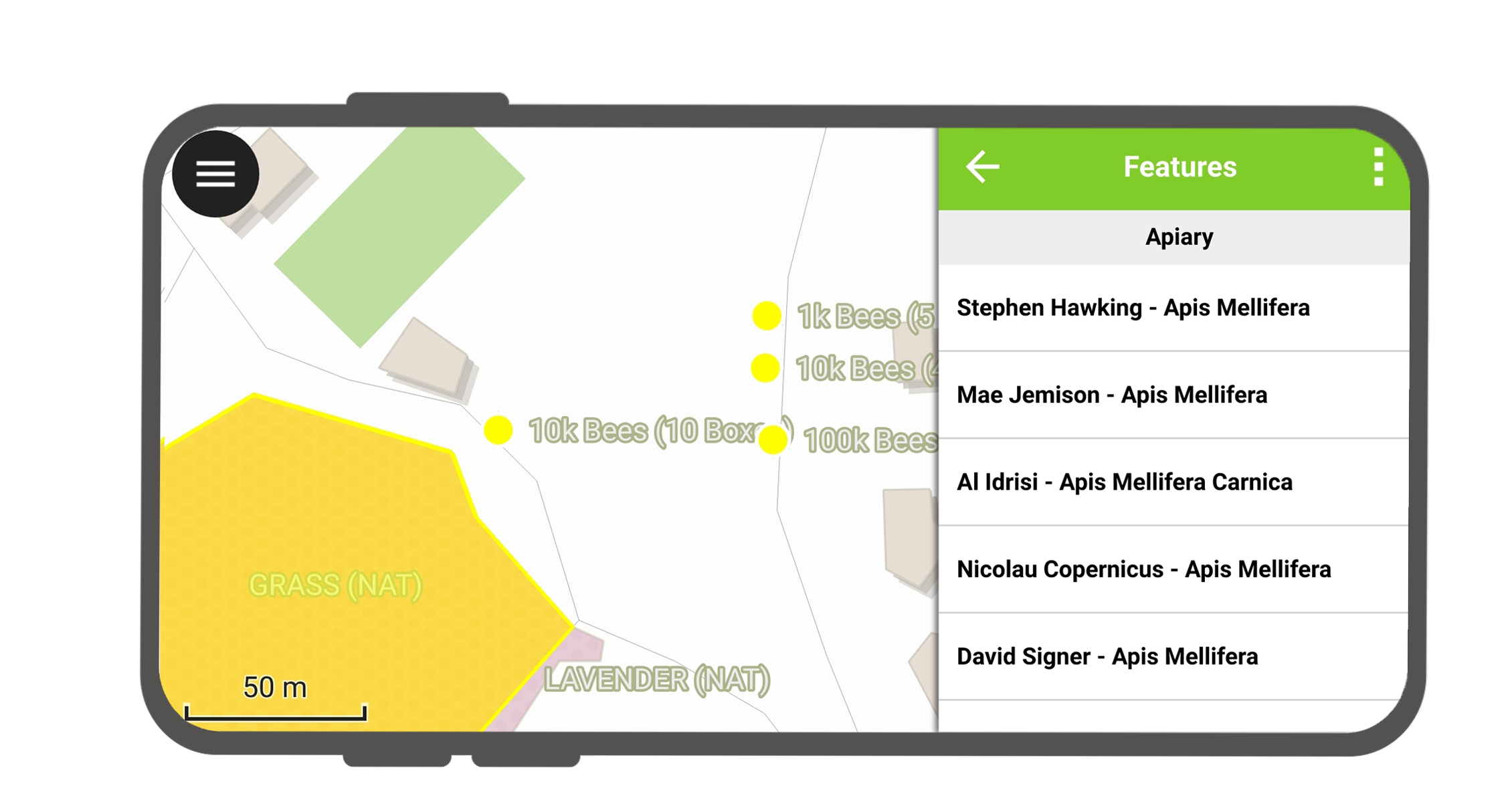
Tocca uno degli elementi elencati per accedere ai relativi attributi.
- Tocca le frecce per scorrere tutti gli elementi identificati.
- Tocca il pulsante centra per centrare la mappa sull'elemento selezionato.
- Tocca il pulsante modifica per modificare gli attributi degli elementi selezionati.
- Scorri i sottomenu per accedere a tutti gli attributi.
Seleziona gli elementi identificati
Premendo a lungo, puoi alternare la selezione degli elementi.
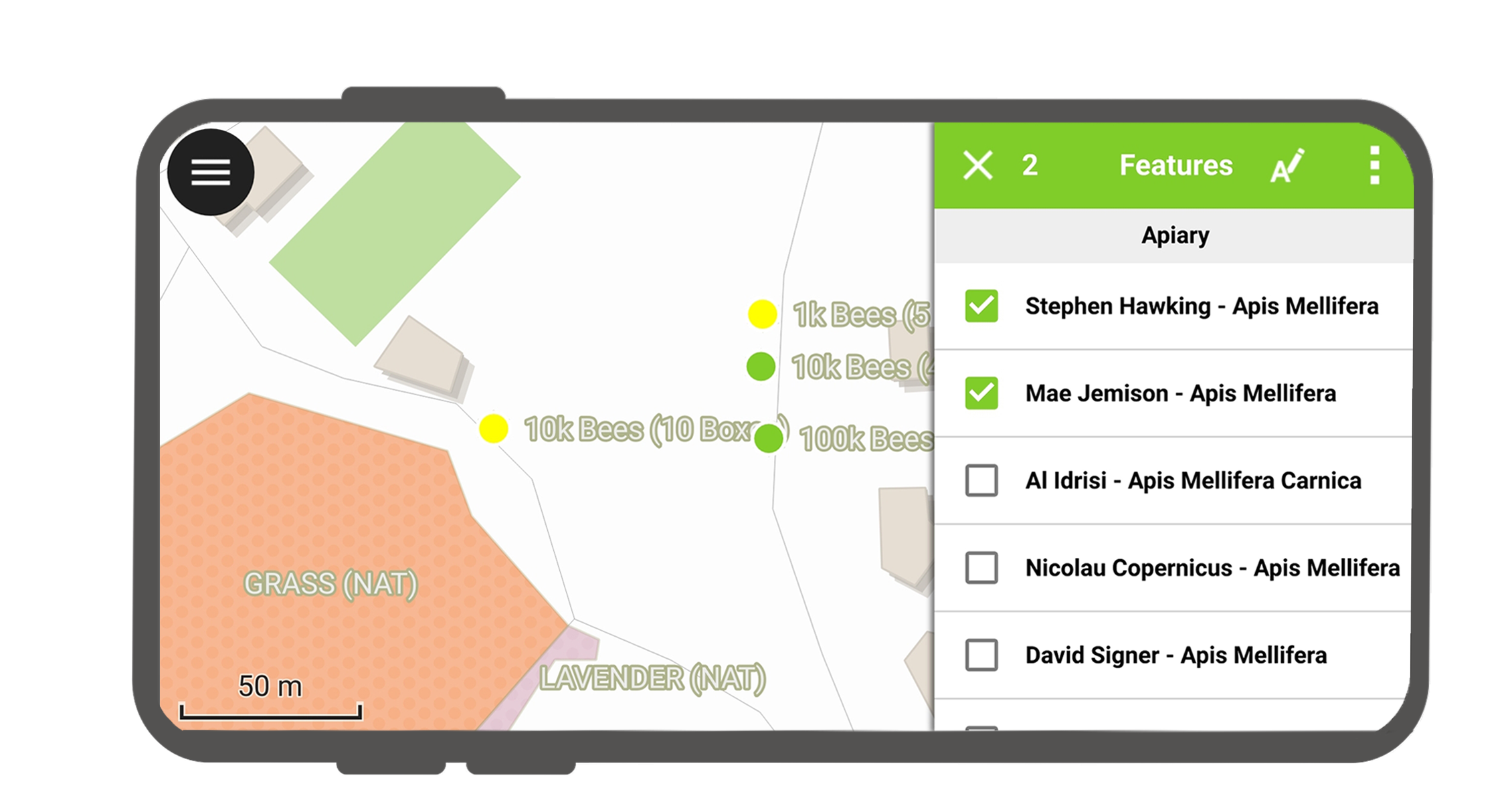
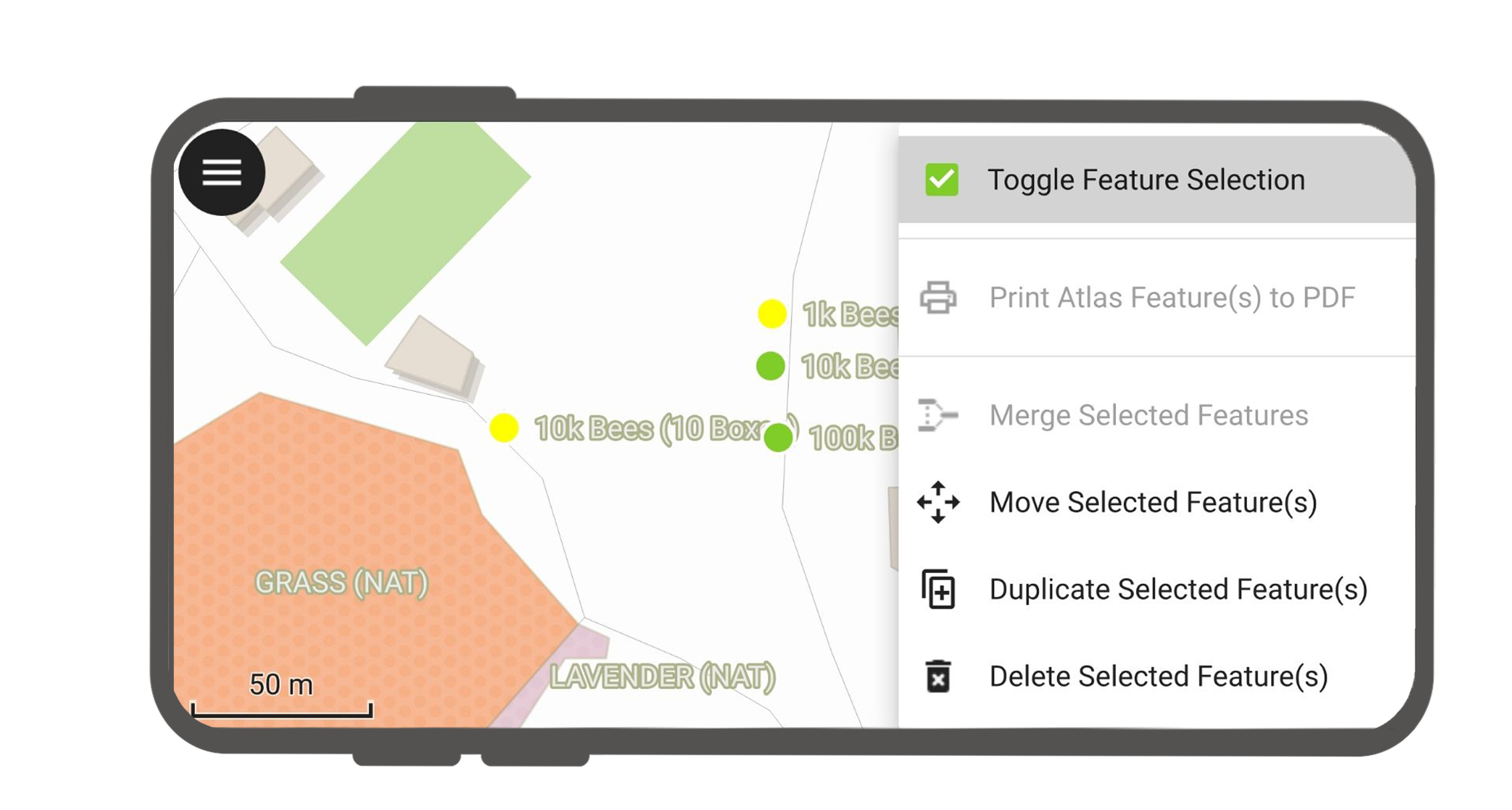
Quando gli elementi sono selezionati, è possibile eseguire le azioni nel menù tre-punti in alto a destra.
Eccezioni ai layer identificati
Spesso non è necessario essere in grado di interrogare ogni layer. Alcuni layer sono presenti solo come mappa di base, e i loro attributi non sono interessanti.
You can manage this layer list in QGIS desktop in Project > Project Properties > Data sources > Identify Layers and uncheck the base layers.