Interagiere mit der Karte
Hier sind einige der möglichen Interaktionen mit der Karte in QField.
Karten Legende
Feldarbeit
Öffnen Sie das Hauptmenü und erweitern Sie die Layerliste, um die Legende der Karte anzuzeigen.
Durch Doppeltippen oder langes Drücken auf einen Layer werden Ihnen die folgenden Möglichkeiten angeboten.
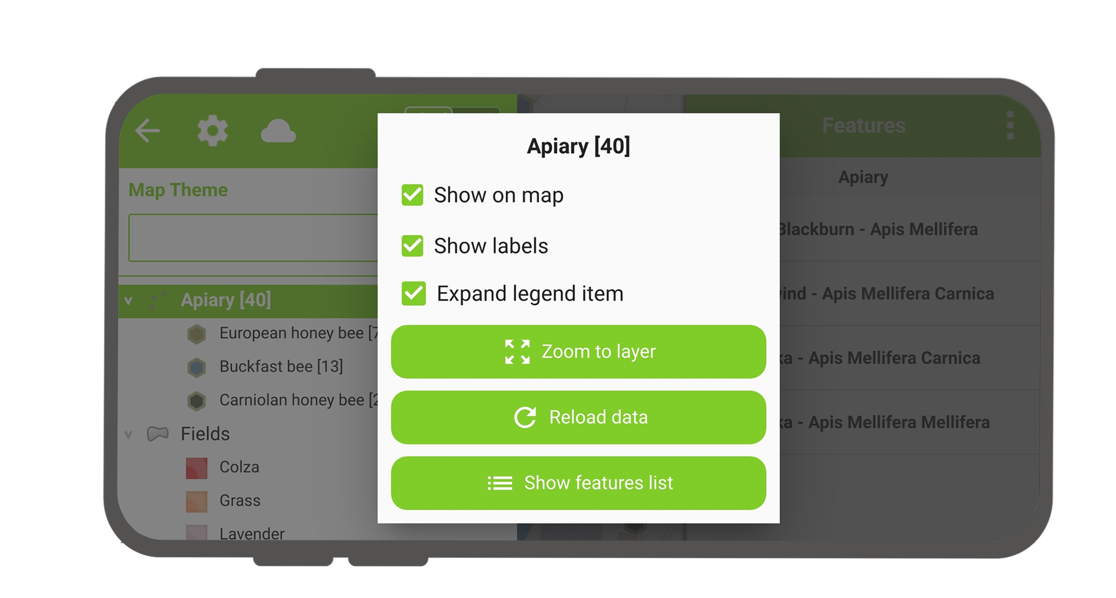
- Legendenelement erweitern, um die Unterelemente eines Layers ein- und auszublenden.
- Auf der Karte anzeigen, um die Sichtbarkeit zu kontrollieren.
- Beschriftungen anzeigen, um die Sichtbarkeit der Beschriftungen zu steuern.
- Opacity Slider to control the transparency of the layer.
- Zoom auf Layer, um alle Elemente eines Layers auf der Karte anzuzeigen.
- Reload icon to get the current data of a layer with remote sources.
- Merkmalsliste anzeigen, um alle Merkmale eines Layers in der Identifikationsliste anzuzeigen.
- Setup tracking to set up tracking mode of layer.
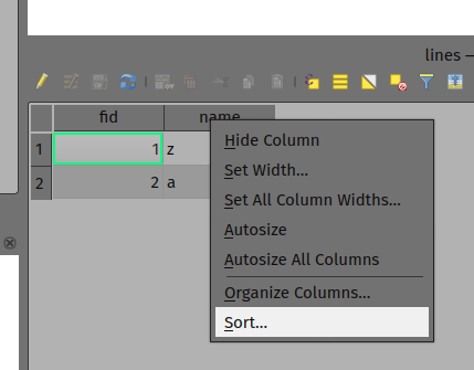
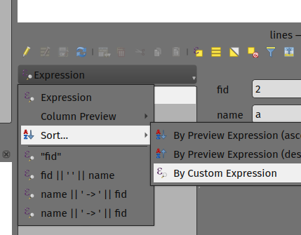
Layer-Merkmale sortieren
Vorbereitung am Schreibtisch
Wenn Sie die Reihenfolge der Merkmale in 'Merkmalsliste anzeigen' in QField konfigurieren möchten, haben Sie die folgenden Möglichkeiten, diese vorzukonfigurieren:
- Klicken Sie einfach mit der rechten Maustaste auf einen beliebigen Teil einer Spaltenüberschrift und wählen Sie die Option "Sortieren" aus dem Menü. Auf diese Weise können Sie nach Bedarf komplexe Sortierausdrücke für Ihre Merkmale eingeben.
- When being in the form view, you can access the sorting functionality by clicking on the expression button located at the top of the features list and select the 'Sort' option.
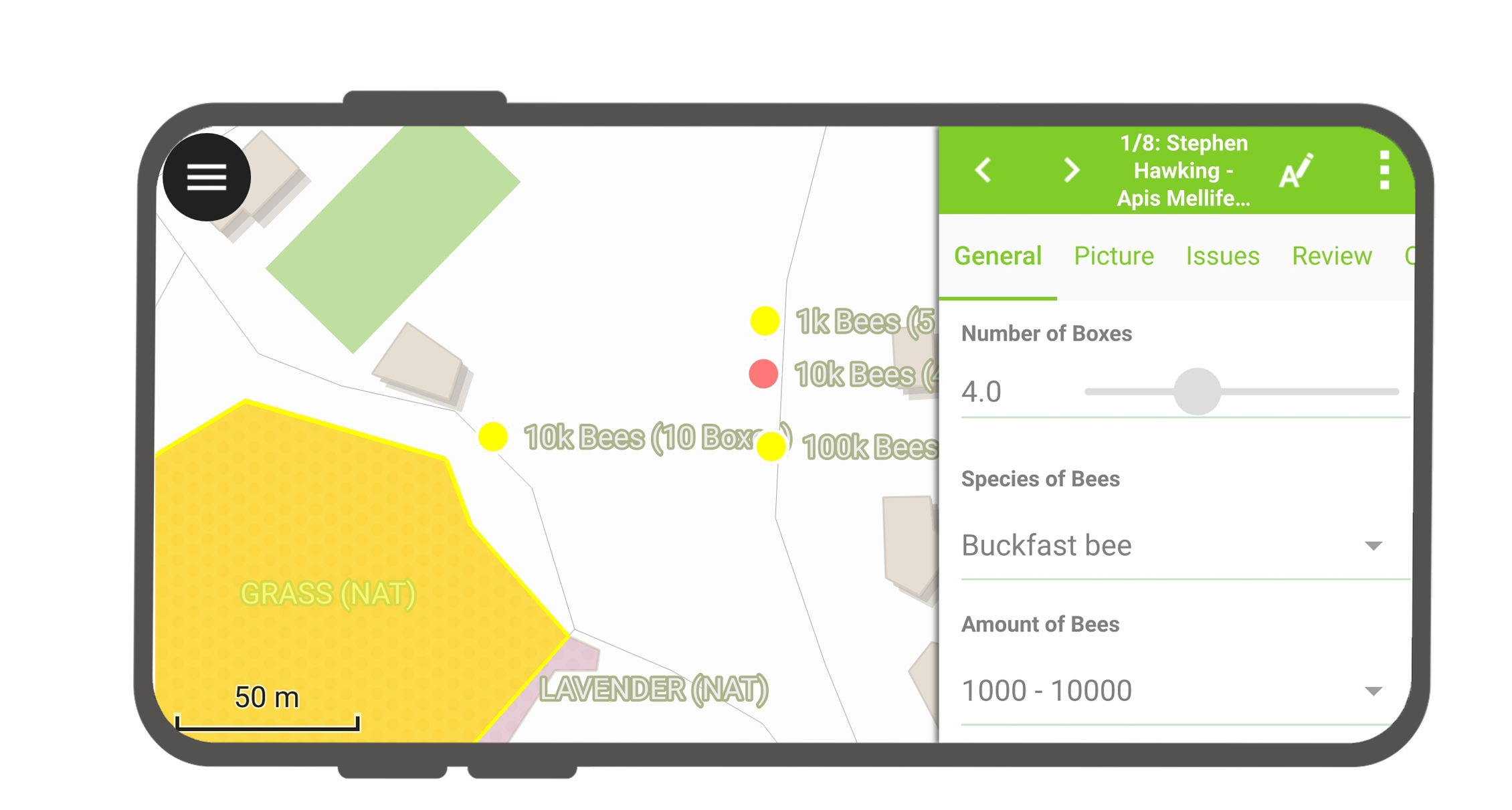
Objekte identifizieren
Feldarbeit
Tap on a feature on the map to identify it. If several features are located where you tapped (either because there are multiple features really close one to another, or because several layers are overlapping), they will all be listed in the menu that opens on the right of the screen.
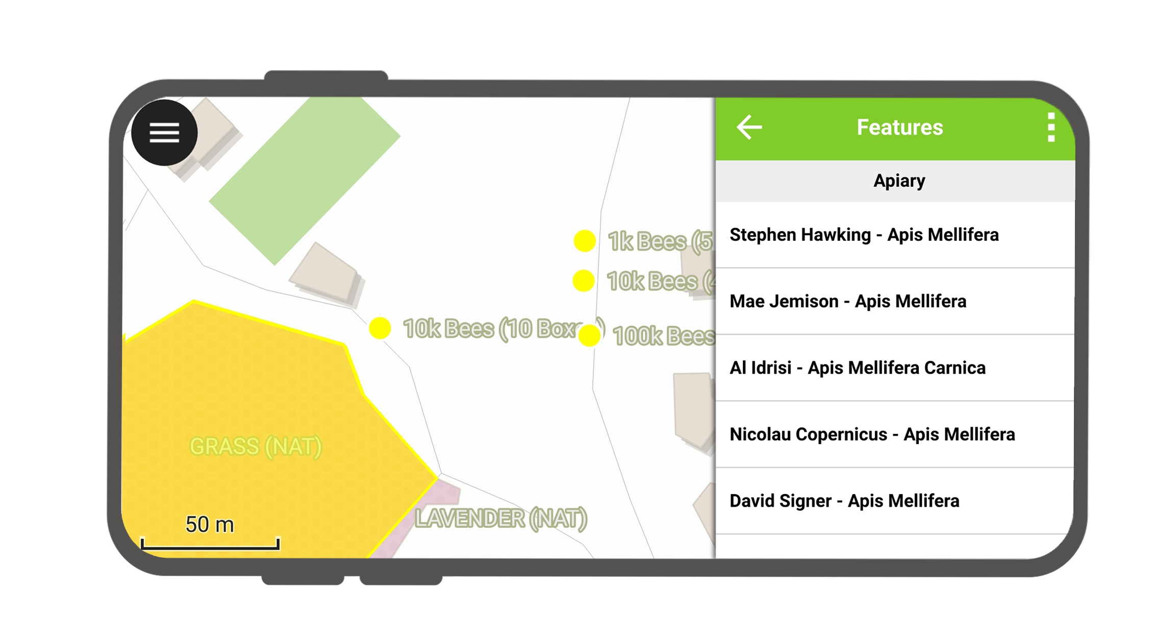
Tippen Sie auf eines der aufgelisteten Merkmale, um auf dessen Eigenschaften zuzugreifen.
- Tippen Sie auf die Pfeile, um durch alle identifizierten Merkmale zu blättern.
- Tippen Sie auf die Schaltfläche Zentrieren, um die Karte auf das ausgewählte Merkmal zu zentrieren.
- Tippen Sie auf die Schaltfläche Bearbeiten, um die Attribute des ausgewählten Merkmals zu bearbeiten. Objekt.
- Blättern Sie durch die Untermenüs, um auf alle Attribute zuzugreifen.
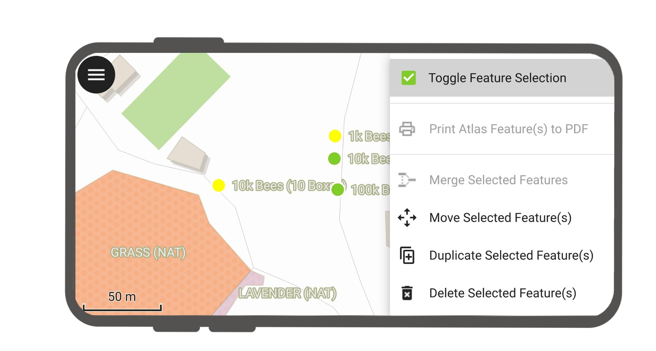
Identifizierte Merkmale auswählen
Durch langes Drücken können Sie die Merkmalsauswahl umschalten.
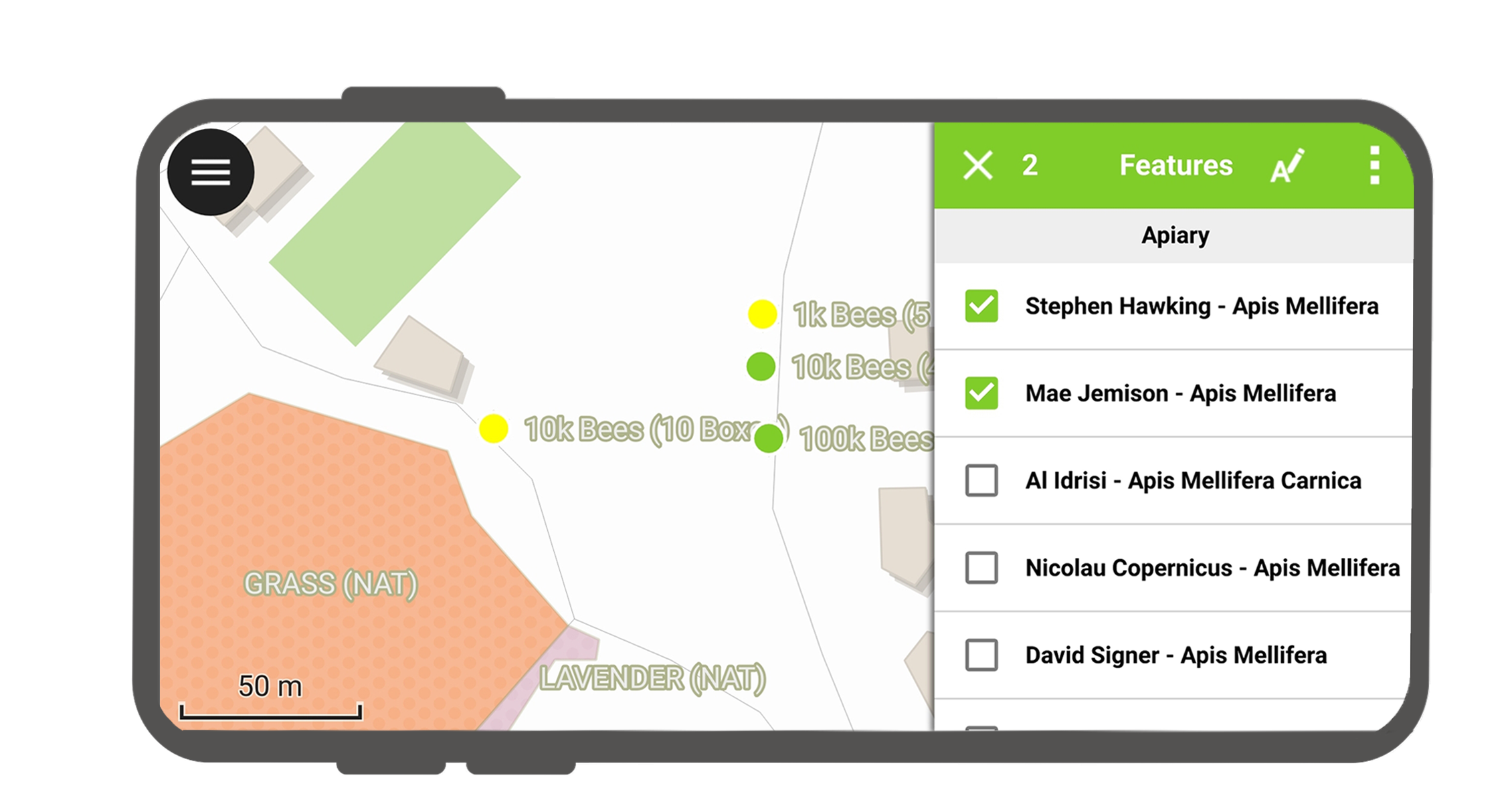
Wenn Merkmale ausgewählt sind, können Sie die Aktionen ausführen, die im Drei-Punkte-Menü oben rechts angezeigt werden.
Nichtidentifizierbare Ebenen
Oft ist es nicht erforderlich, jeden Layer abfragen zu können. Einige Layer sind nur als Basiskarte vorhanden, und ihre Attribute sind nicht von Interesse.
You can manage this layer list in QGIS desktop in Project > Project Properties > Data sources > Identify Layers and uncheck the base layers.