Projekte
Projects are the main data containers on QField and QFieldCloud. There is no limit on the number of projects.
Projects must contain
- A single .qgs/.qgz QGIS file
- (Optional) Spatial and non spatial files -- GeoPackages, Shapefiles, TIFs, tables
- Photos, videos or PDFs etc.
File Size Recommendations to ensure optimal performance:
- Recommended Limit: For optimal performance, keep individual file sizes under 2 GB.
- Absolute Maximum: The system's hard limit is 10 GB. Files larger than this will fail to process.
Larger files than this may take significantly longer to process and lead to jobs issues. It is therefore recommended to:
- Divide large files into smaller pieces
- Check the On-demand Attachment files download
Files cannot be shared between projects, unless shared datasets are used.
QFieldCloud projects have a name and an owner.
The owner of a project is a QFieldCloud user or an organization.
It is not possible to use the same pair owner_name and project_name.
Projects can be marked as either public or private.
- Private projects: These projects are only accessible to users that have been added as project collaborators.
- Public projects: These projects are accessible to all and can be downloaded by, any QFieldCloud user.
Ein Projekt erstellen
Ein Projekt kann auf unterschiedliche Weise erstellt werden:
- via QFieldCloud web interface;
- via QFieldSync in QGIS;
- via QFieldCloud-SDK;
Dateien
Dateien sind das Skelett, auf dem das QFieldCloud-Projekt aufbaut. Um ein QFieldCloud-Projekt zum Leben zu erwecken, müssen Benutzer mindestens eine einzelne QGIS-Projektdatei im .qgs oder .qgz Dateiformat hochladen. Alle Geodateien müssen mit denselben relativen Pfaden wie auf dem Computer hochgeladen werden. Wenn eine externe SVG- oder Raster-Symbolisierung verwendet wird, müssen Benutzer auch die entsprechenden Dateien hochladen.
Anmerkung
QFieldCloud unterstützt keine Projekte, die in einer GeoPackage-Datei (.gpkg) gespeichert sind (Benutzer können jedoch GeoPackage-Dateien verwenden, um Datensätze für ihre Projekte zu speichern).
Eine typische Dateistruktur einer QGIS-Datei könnte etwa so aussehen:
project
├── data
│   ├── basemap.tif
│   ├── bees.gpkg
│   └── fields.gpkg
├── symbology
│   ├── icon.svg
│   └── line-pattern.png
├── DCIM
│   ├── bees-20220404121212.jpg
│   ├── bees-20220405040506.jpg
│   └── fields-20220405040607.jpg
├── project.qgs
├── project_attachments.zip
└── project.qml
Die Dateien in einem QGIS-Projekt können sich je nach ihrem Zweck in einer der folgenden Gruppen befinden:
- QGIS-Projektdatei - eine
.qgsoder.qgzProjektdatei. - QGIS Sidecar-Dateien - Dienstprogrammdateien zur QGIS-Projektdatei, wie z.B.
*_attachments.zipoder andere Sidecar-Dateien. - Datenquelldateien - alle Vektor- und Rasterdaten, z. B.
.gpkg,.tif,.mbtilesoder andere Datenquelldateien. - Anhänge - alle zusätzlichen Projektdaten, wie
.jpg,.pdfoder andere Dateien. - QField-Plugins - alle QField-Plugins, normalerweise
.qmlDateien.
Dateiversionen
QFieldCloud uses file versioning. This allows users to restore any modified file to a previous version. Files and file versions can be found under the Files section of your projects. Subscriptions plans allow a different number of versions per file. See the qfield.cloud pricing page for further details.
Alte Dateiversionen löschen
To ensure that only relevant file versions are kept, and to reduce the amount of storage needed by accounts, users can delete obsolete file versions. One can manually delete file versions from the project's File section. Each file and version can be linked to a specific QFieldCloud user who uploaded it.
Um Dateiversionen in QFieldCloud zu löschen, gehen Sie folgendermaßen vor:
Workflow
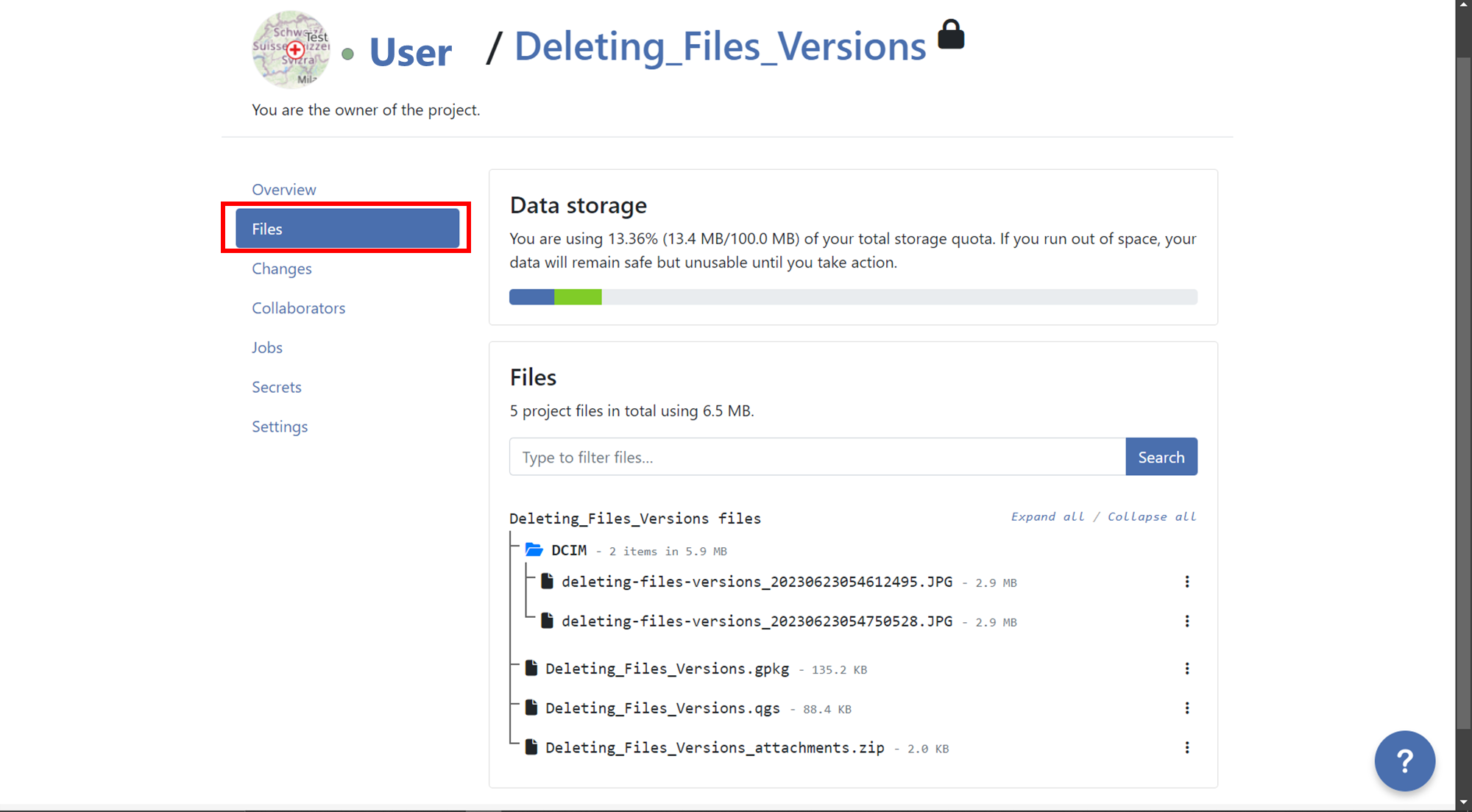
- Go to the "Files" section of your project.
- Locate the file for which you want to delete versions.
- Click on the 3-dotted menu (⋮) on the right side of the file name.
- You will see a list of versions for that specific file.
- Identify the version you want to delete and click on the red trash bin icon next to it.
- Confirm the deletion when prompted, if you want to delete all versions before a specific version,
you can do it activating the option Also delete
nversion(s) older than the selected version.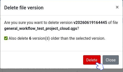
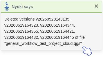
- After deleting a pop up message will appear with the success and the list of versions will show just the versions that was not selected for deletion.
Mitarbeiter
A project collaborator is a QFieldCloud user invited to contribute to a project. A single project may have multiple collaborators. Collaborators with roles owner or admin can add more users as collaborators. Projects owned by an organization allow adding teams as collaborators. Read more about collaborator roles.
Änderungen
Changes made on vector layers and uploaded to QFieldCloud from a QField device will appear here. A change stores the difference between attributes or geometries before and after the upload.
Änderungen registrieren, welche Methode zum Hochladen verwendet wurde. Es kann sich um eine der folgenden Optionen handeln:
Erstellen- Eine neue Funktion wurde erstellt.Entfernen- Eine vorhandene Funktion wurde gelöscht.Patch- Eine vorhandene Funktion wurde geändert.
Objekte, die erstellt und später gelöscht wurden, ohne an QFieldCloud gesendet zu werden, erscheinen nicht in Projektänderungen.
Anmerkung
Änderungen an Online-Vektor-Layern (PostGIS, WFS), die nicht über die Cloudlayer-Aktion "Offline-Bearbeitung" verfügen, erzeugen keine Änderung, sondern ändern die ursprüngliche Datenquelle direkt.
Anmerkung
Änderungen an Vektorlayern, die in QGIS vorgenommen wurden, werden hier nicht angezeigt.
Aufträge
Lies mehr über Projekt-Aufträge.
Geheimnisse
Geheimnisse sind Projekteinstellungen, die sicher und verschlüsselt gespeichert werden. Jobs haben automatisch Zugriff auf die Geheimnisse des Projekts.
Read more about project secrets.
Einstellungen
Projekteinstellungen sind nur für Projektinhaber und Mitarbeiter mit einer "Admin"-Rolle verfügbar. Einstellungen sollten mit Bedacht gehandhabt werden, da Benutzer vertrauliche Projekteinstellungen ändern und nicht wiederherstellbare Aktionen ausführen können.
- Ändern Sie die Sichtbarkeit des Projekts in Öffentlich.
- Ändern Sie den Projektinhaber.
- Ein Projekt dauerhaft löschen.
- etc
Warning
Actions issued from a project's settings page can lead to data loss!
Restrict Project Files Modifications
When this setting is enabled, the ability to modify, overwrite, or upload changes to the core QGIS/QField project files (.qgs/.qgz/.qgd or QField project plugins)
are strictly restricted to collaborators with Admin or Manager roles.
Collaborators with Editor or Reporter roles will still be able to seamlessly edit data, push delta changes, and upload non-project files to the cloud like attachments (pictures, audios, videos or PDFs documents), but they will be prevented from altering the main project files. This is highly useful for ensuring field workers can synchronize data without accidentally breaking the project's layers, styling, or overall configuration.
