QField general settings
Trabajo de campo
The general settings screen allows you to control the basic appearance and behavior of QField. You can access the general settings in two ways.
Workflow
Access settings from the Welcome Screen:
- Open QField and tap the settings button on the top-left corner of the screen.
Access settings inside an active project:
- Open the Side Dashboard.
- Tap the three-dotted menu (⋮) and select Settings.
En las siguientes secciones se describirán las diferentes opciones de configuración.
Map canvas
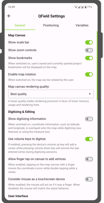
- Show scale bar: By enabling the Show scale bar it will show the scale bar on the map.
- Show zoom controls: By enabling this option, the zoom buttons (+/-) will appear on the map.
- Show bookmarks: By enabling this option, your personal locally created bookmarks and currently opened project bookmarks will be displayed on the map.
- Enable map rotation: When enabled, you can rotate the map.
- Map canvas rendering quality: If high memory use is an issue, you can reduce the rendering quality which lowers the memory usage and the rendering time. Esto tiene un coste en términos de precisión en la representación.
Digitizing & editing
- Mostrar información de digitalización: al habilitar esta opción, la información de coordenadas, como latitud y longitud, se muestra debajo de la mira mientras se digitalizan nuevas funciones o se usa la herramienta de medición.
- Fast editing mode: If enabled, QField will immediately and automatically save any changes made during an edit operation.
- Usar las teclas de volumen para digitalizar: Si esta opción está habilitada, al presionar la tecla para subir el volumen del dispositivo se agregará un vértice, mientras que al presionar la tecla para bajar el volumen se eliminará el último vértice ingresado durante las sesiones de digitalización.
-
Permitir tocar con el dedo el lienzo para agregar vértices: Si está habilitado, al tocar el lienzo del mapa con un dedo se redirigirá el cursor de coordenadas a la ubicación requerida. Esta opción es útil cuando se mapean entidades a una escala mayor.
-
Considere el ratón como un dispositivo de pantalla táctil: Si está habilitado, el ratón le permite agregar nuevos vértices en cualquier parte del mapa. If disabled the cross-hair is fixed to the center and the mouse is used to relocate the cross-hair.
User interface
-
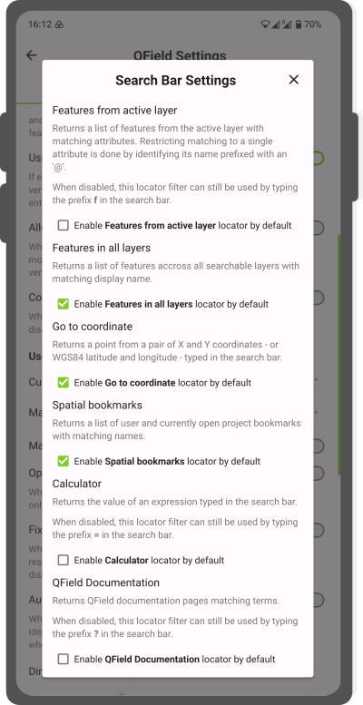
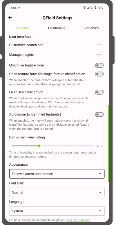
Customize search bar: When pressing the 3-dotted menu (⋮) under the general settings section, a new window will open from which you can personalize your search options.
- Features from active layer: By enabling this option, you will automatically query the layer that is currently active (it is highlighted in the legend). Puede refinar aún más su búsqueda agregando un signo "@" al comenzar su búsqueda para consultar solo un atributo. Cuando está deshabilitado, aún puede acceder a este filtro localizador escribiendo el prefijo f en la barra de búsqueda.
- Features in all layers: When enabling this option, you can search all features across all layers. Si la opción "Características de la capa activa" está habilitada, aún puede buscar en todas las capas agregando el prefijo af al comienzo de su búsqueda.
-
Go to coordinate: By enabling this option, you can simply copy and paste longitude and latitude values to direct to specific locations that are not part of your feature layers. Si está deshabilitado, aún puede acceder a esta opción escribiendo go al comienzo de su consulta.
Tip
When long-pressing on a point of interest anywhere in your map, you can copy the point location to your clipboard and directly place it in the search bar. Remember to type Go in advance if the Go to coordinate setting has not been enabled and remove the information about the coordinate reference system.
-
Spatial bookmarks: By enabling this option you automatically when using the search bar, the list of pre-configured bookmarks (if any) will be queried. Si está deshabilitado, aún puede acceder a esta opción escribiendo b al comienzo de su consulta.
- Calculator: By enabling this option, you can do simple calculations and copy the results directly to the clipboard, if necessary. Si está deshabilitada, aún se puede acceder a la calculadora escribiendo = al principio de la consulta.
- QField Documentation: If enabled it will return the corresponding documentation pages matching terms. Cuando está deshabilitado, la documentación aún se puede consultar colocando un "?" al comienzo de la consulta.
Search Bar Settings -
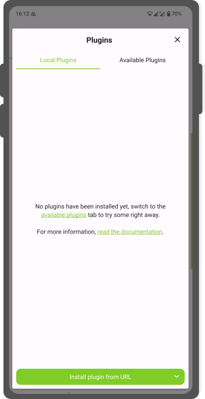
Manage plugins: By pressing the 3-dotted menu (⋮) a new window will open from which you can enable and disable customised plugins. Para agregar un nuevo complemento, consulte la Página de complementos
Plugin dialog -
Formulario de atributo maximizado: al habilitar esta opción, puede maximizar el formulario de atributo para cubrir toda la pantalla.
- Navegación con escala fija:
- Active fixed scale navigation: Focusing on a search result will highlight and pan to the feature.
- Disabled fixed scale navigation: it will pan, highlight and zoom to the feature.
- Automatically open form for single feature identification: If enabled, when tapping on an individual feature while being in the browse mode, the attribute form will directly be opened.
- Dim screen when idling: To preserve battery, you can change the time when you want your phone to dim the screen when being inactive on QField. When setting it to 0 the dimming will be disabled completely.
- Appearance: Depending on your preference, you can change the QField interface to Light or Dark Mode.
-
User interface font size: You can choose from the following options:
- Pequeño
- Normal
- Grande
- Extra-grande
-
User interface language: QField will by default utilize the language present on your device, if a translation is available. You are cordially invited to enhance the translation in your native language.
Avanzado
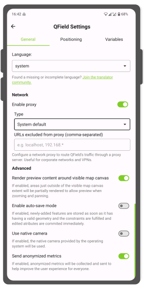
Net proxy
If some of your data are located in a closed environment you can access them through a proxy network. This should be configured in QGIS beforehand.
QField also can access the data once the network information is provided:
- Type: Choose the type of proxy you wish to add (eg. HTTP or SOCKS5)
- URLS excluded from proxy: You can add selected URLs that can route QField's traffic through a proxy.
Usar cámara nativa
QField tiene su propia cámara interna, que ofrece numerosas opciones si se desea:
- Geotagging and EXIF variables
- Detalles del estampado
- Size and ratio adjustment
- Selección de cámara: frontal y trasera
Información
Si está habilitada, QField utilizará la cámara interna específica del sistema del dispositivo. A menos que se produzcan errores al utilizar la cámara específica de QField, se recomienda utilizar la de QField.
Enviar métricas anonimizadas
Si se habilita, se recopilarán y enviarán métricas anónimas para ayudar a mejorar QField para todos. No se enviarán datos personales de la cuenta al equipo de desarrollo de QField.