Digitize and edit
With QField you can digitize, edit and delete points, lines and polygons and their corresponding attributes while being in the field. If you only want to edit your attributes, it is enough to stay in Browse Mode. If you, however, want to add a new object or edit the geometry of an existing one, you will have to switch to Digitize Mode.
Adding new objects
Adding point objects
Flujo
- Navigate the crosshair in the center of the screen to where you want to add the point.
-
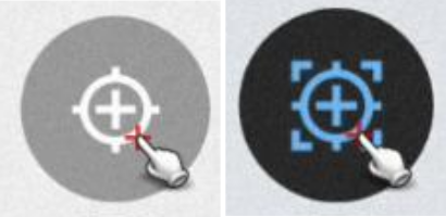
Click the at the lower right of the screen to add a new point. (Optional): You can use the lock to position button from the pie menu to force the crosshair to take the point directly at your position - if you have enabled your position.
-
(Optional): You can click the red X to cancel the current addition.
Adding line or polygon objects
Flujo
- Navigate the crosshair in the center of the screen to where you want to start the line or the polygon.
- Click the at the lower right of the screen to add the starting point.
- To form your line or polygon tap on the each time you want to add a new point.
-
(Optional) Click the to remove the last added one.
-
Click on the to finish your edit. You need to add at least 2 nodes for line features and 3 for polygons.
-
(Optional): You can click the X to cancel the current feature creation.
Additional editing settings
Hay otras configuraciones más avanzadas que puedes habilitar para que la recopilación de datos sea más eficiente:
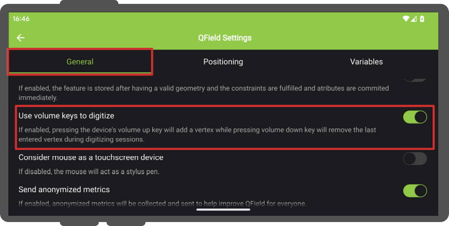
- Use volume keys to digitize: If you want to avoid to have to tap on your device for every point you can enable this option to add and remove points using the volume keys. Nota: Esta función solo está disponible para dispositivos Android
- Allow finger tap on canvas to add vertices: If you want to use your finger to add points as well rather than having to press the button the whole time, you can activate this option.
Flujo
- To enable both options, open the Side Dashboard
- Tap on the 3-dotted menu at the top right.
- Direct to Settings > General
Formulario de atributos
After digitizing a geometry, the attribute form will appear allowing you to add attribute values for the new object.
Add values using the QR and barcode
Flujo
- Open the attribute form of your object.
- Tap on the 3-dotted menu (⋮) next to the field which you wish to add or edit
- You will see the following options
- Copy
- Paste
- Scan Code: You can also read NFC text tags with the Code Reader
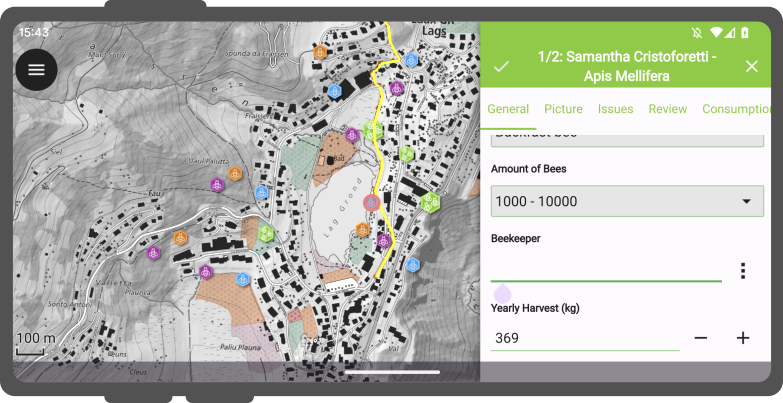
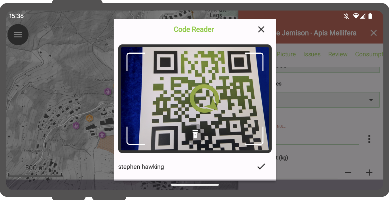
- Click on the Scan Code option
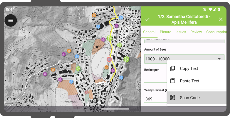
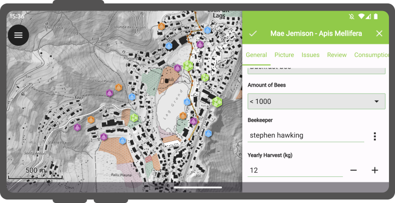
- Scan the QR Code and click on the
Nota
Tanto la cámara para códigos QR como el detector de etiquetas de texto NFC están habilitados de forma predeterminada al abrir el lector de códigos. Tienes la flexibilidad de desactivar cualquiera de estas funciones para asegurarte de que la batería de tu dispositivo no se agote innecesariamente al utilizar hardware que quizá no necesites en ese momento.
Recordar los valores de los atributos
If you want to reuse values from previous entries, you can use the next to the different fields to make QField remember the last value, you added to a specific field.
Nota
This only works when you add a new object.
Editing existing geometries
Flujo
- Switch to the Digitize Mode: Open the Side Dashboard and press the
- Go back to the map canvas and find the object you wish to edit.
- Tap on the object you wish to edit.
- Tap on the Edit Button
-
Now you will have the option to choose between
- A Editor tool: The vertex editor allows you to move or delete pre-existing vertices as well as adding new vertices to geometries.
- A Split tool: The split tool allows you to split objects into two new objects. The new object(s) will be filled with the same attributes as the original.
- A Reshape tool: You can reshape the geometry of your corner, by simply drawing a line on top or the object.
- An Eraser tool: If you need to make a hole or erase some parts of your object, you can use this tool.
- Ring Tool: Within an object, you can create a ring. QField will ask whether you wish to add a new polygon as a replacement of the deleted one into the hole.
Editor tool
Herramienta de remodelación
Herramienta de división
Eraser tool
Herramienta Anillo
Fusionar objetos espaciales
QField allows you to merge objects and their geometries to become one.
Flujo
- Tap on the first object you want to merge.
- Long-Press on it and select it
- Add as many more as you want to merge.
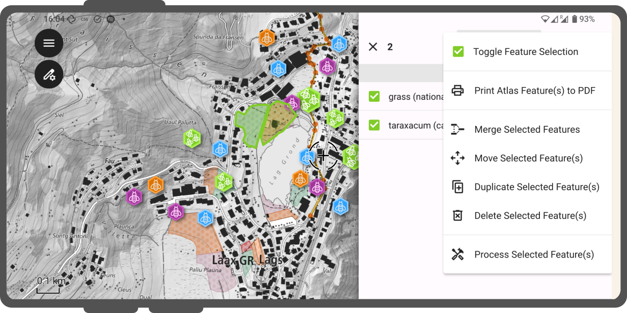
- Open the 3-dotted menu on the top right.
- Click on Merge Selected Features.
Multi-Select
Digitalización a mano alzada
If you are working with a stylus, you can draw freehand. The mode is available for lines and polygons. You can also use them to edit the existing geometries of other objects.
El modo de digitalización a mano alzada se activa mediante un nuevo botón de la barra de herramientas que aparece cuando QField está en modo de edición y se pasa un lápiz óptico o un ratón por el lienzo del mapa mientras se selecciona una línea o un polígono vectorial.
Autoensamblado
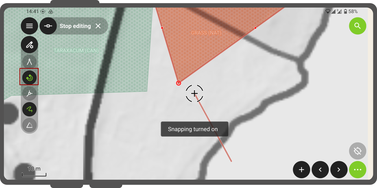
When adding new objects it is possible to enable the snapping tool, which allows you to snap new objects to the boundaries or corner points of existing ones.
Flujo
- Change to the Digitize Mode.
- Once activated on the top left below the Side Dashboard a icon becomes visible.
- Open an existing or add a new object to the map.
- Click on the and enable the
Snapping
Nota
The level of snapping depends on the rules that were set in the QGIS project. You can read more about this here
Snap to common angle
You can snap to an angle of your choice.
Flujo
- Change to the Digitize Mode.
- Once activated on the top left below the Side Dashboard a icon becomes visible.
- Add a new line or polygon object by pressing the .
- Click on the and long-press on the Angle Symbol.
- Select amongst one of the pre-defined angles: 10°, 15°, 30°, 45°, and 90° and enable the function by tapping on the angle. QField will remember the angle relative to the last segment situation for consistent snapping behaviour during subsequent edits.
Edición topológica
Topological editing corresponds to that two or more objects with shared boundaries can be modified together to avoid gaps in between them. Whether you have this enabled in your project, depends on the settings that were defined in the underlying QGIS project. Below is an example what this looks like:
Editing multiple attributes
You can edit the attributes of multiple objects at once.
Flujo
- Long-press on one object and select
- Add as many others as you want to edit.
- Click on one of the features and edit the attribute(s) that you want to edit.
- Tap the to save your edits.
- Now all the attributes of the selected features will have updated.
Copy, cut and paste
You have the possibility to copy, cut and paste your attributes from one layer to another. This function is achieved by attribute matching. If there are any matching attributes in the target layer, the copied feature will copy the values where fields are matching while others non-matching fields will remain blank. The same applies when cutting a feature from one layer to another. The geometry type does not matter.
Check out the video to see the copy, paste function in action.
Borrar objetos
Flujo
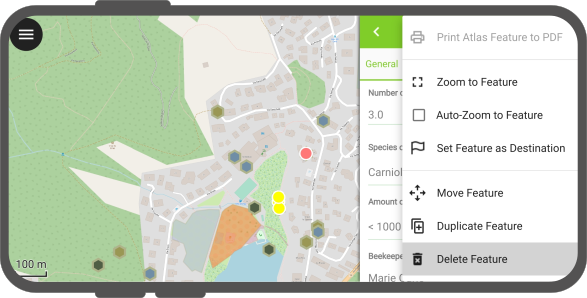
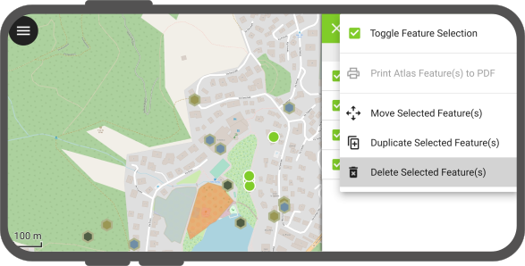
- Tap on an existing feature and select it by either
- Opening the attribute form of one object
- Long-pressing on the identified object(s).
- Open the 3-dotted menu
- Select Delete feature(s)
Geocercado
QField has a built-in geofencing functionality that can alert or inform users when the position provided by their GNSS device enters and/or leaves areas defined through polygon features. Digitizing of new features can also be prohibited when a geofencing alarm is turned on. Defining geofenced areas on QGIS happens with the help of the QFieldSync plugin.
When QField turns its geofencing alert on, a glowing red circle will appear at the bottom right corner of your screen. The message will stay until you have left the prohibited area. If your device supports vibration, it will also vibrate as long as you are in the area.
If the project was prepared in such a way that prevents you from digitizing in the prohibited area, you will notice that QField's digitizing toolbar will disappear while in alert mode to clearly inform users of the ongoing prohibition and avoid accidental data entry.