Digitize and Edit
With QField you can digitize, edit and delete points, lines and polygons and their according attributes while being in the field. Similar to QGIS, QField has two modes. The browse mode and the digitize mode.
Browse Mode
As the name suggests, while being in browse mode, you can view and select features within all identifiable layers in the project. It is also possible to edit attributes of existing features, by clicking on a feature of interest and opening its attribute table.

Digitize Mode
Feldarbeit
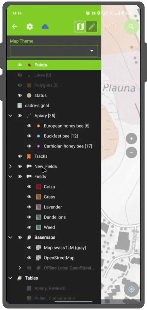
To start digitizing new features, enable the Digitize mode by clicking on the pencil icon in the side "Dashboard" and selecting the layer within which you want to add new features. The current layer within which features are to be added is highlighted in green.

Tip
QField insures that digitized geometries will not have duplicate vertices and respects the geometry precision settings from the currently selected layer.
Punktsymbole hinzufügen
Workflow
- Navigate the crosshair in the center of the screen to the desired location
- Click the Green Plus (+) button at the lower right of the screen add a new point feature. (Optionable): You can use the lock to position button to force the crosshair to center on your location if you have enabled positioning.
- (Optionable): You can click the (x) button to cancel the current feature creation.
![]()
Linien oder Polygone hinzufügen
Worlflow
- Navigate the crosshair in the center of the screen to the desired start of the line or polygon
- Click the Plus (+) button at the lower right of the screen to add the first node.
- Adding more points to form you line or polygon by clicking the Plus (+) button each time you want to add a new node.
-
(Optionable) Click the Minus (-) button to remove the last added node.
-
Click on the Save button to finish your edition. You need to add at least 2 nodes for line features and 3 for polygons.
-
(Optionable): You can click the (x) button to cancel the current feature creation.
Additional Editing Settings
There are other more advanced settings, which you can enable to make your data collection more efficient:
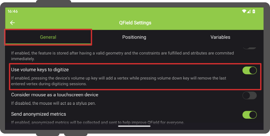
- Use volume keys to digitize: If you want to avoid to have to tap on your device for every note you can enable this option to add and remove nodes using the volume keys. Note: This feature is only available for Android Devices
- Allow finger tap on canvas to add vertices: If you want to use your finger to add notes as well rather than having to press the button the whole time.
Workflow
- To enable both options, open the side "Dashboard" Panel and direct to Settings > General
Attribut-Eingabemaske
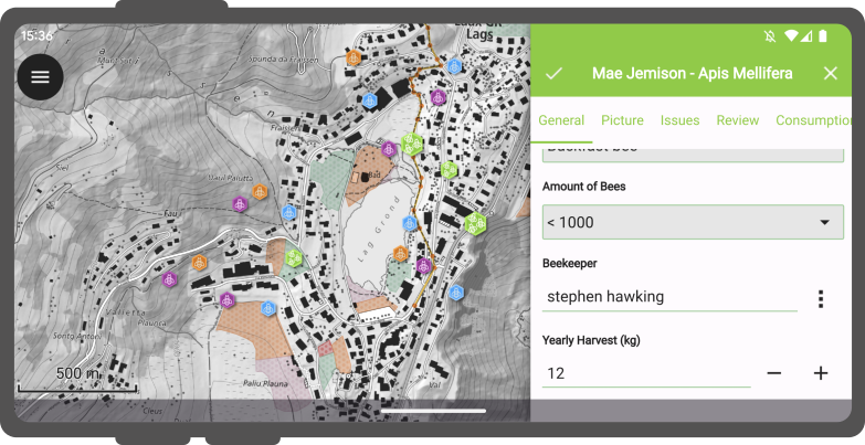
After digitizing a geometry, the attribute form will appear allowing you to edit attribute values for the newly added feature.
Note
You can hide the attribute form upon feature addition via a configuration option for a given layer via its properties dialog in QGIS.
Moreover, you have the option to digitize the form using the scanning QR and Barcode reader functionality available within the feature form's text edit widget.
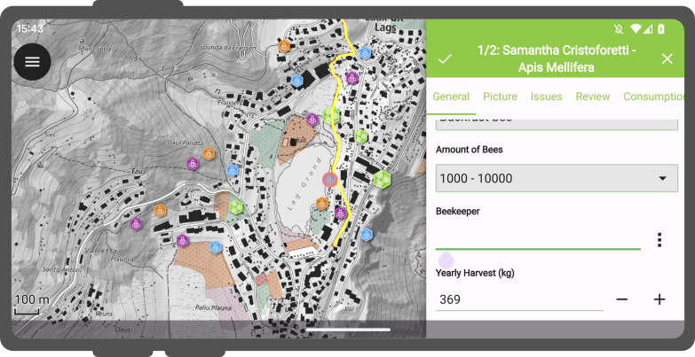
Upon clicking the icon button with the three dots, a menu will be presented offering three distinct actions: "Copy", "Paste", and "Scan Code".
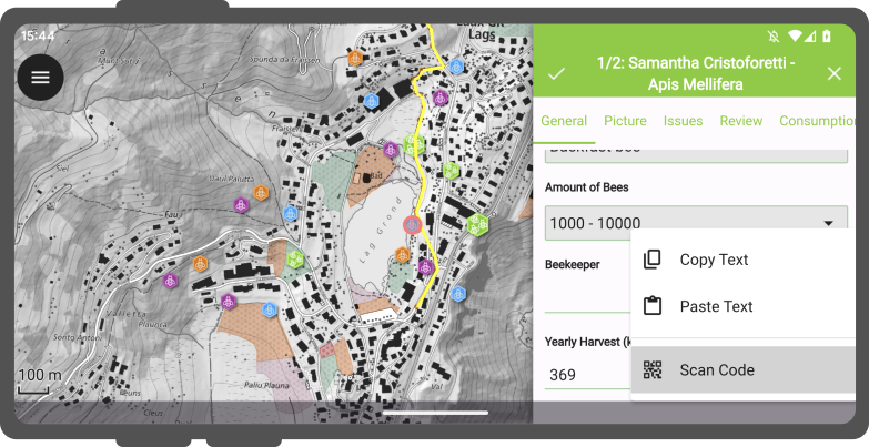
Wenn Sie sich für die Aktion "Code scannen" entscheiden, wird der Codeleser von QField ausgelöst und der Scanvorgang zur Dekodierung eingeleitet.
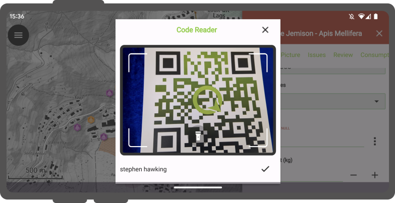
Once the codes have been successfully scanned, users can validate their choice by clicking the checkmark (✔️) OK button. This action will populate the attribute with the decoded value, streamlining the digitization process.
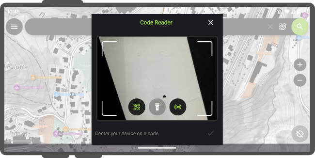
Darüber hinaus bietet der Codeleser die Möglichkeit, NFC-Text-Tags zu lesen.
Note
Both the QR code camera and the NFC text tag detector are enabled by default when you open the Code Reader. You have the flexibility to disable either of these features to ensure that your device's battery is not used unnecessarily by using hardware that you may not need at the moment.
Attributwerte erinnern
For quick collection of rather homogeneous datasets, it is crucial to not having to enter the same attribute values multiple times. The pins on the right of every attribute enable the last entered value option for each attribute individually so that the next time you will add a feature on the same layer, these attributes will be automatically pre-filled. It needs to be noted that this last entered value only applies when collecting new features not when editing existing ones, unless otherwise specified.
Bearbeitung der Geometrie
Feldarbeit
To edit the geometry of pre-existing features, enable the Digitize mode by tapping on the pencil icon underneath the legend.
Once in digitize mode, a new Edit geometry button will appear in the title bar of an identified feature form. Clicking on the button will activate the geometry editing environment which offers four tools:
- Ein Vertex-Editor-Werkzeug;
- ein Werkzeug zur Geometrieaufteilung;
- ein Werkzeug zur Änderung der Geometrie; und
- ein Geometrie-Ring-Werkzeug.
Vertex Werkzeug
The vertex editor allows you to move or delete pre-existing vertices as well as adding new vertices to geometries.
Split-Werkzeug
The split tool allows you to split line and polygon geometries into two halves, one of which will become a new feature of its own.
Umformungs-Werkzeug
The reshape tool allows you to change line and polygon geometries by drawing shapes which will result in a reshaped line following the edge of the drawn shape or a polygon with the drawn shaped used to clip or expand the geometry.
Radiergummi-Werkzeug
The reshape eraser tool is designed to ease the removal of parts of a line or polygon geometry. The tool mimics eraser tools from 2D drawing programs and works best with a stylus.
Suppose you have a polygon representing a building footprint, but there's an unwanted protrusion. You can use the erase tool to precisely remove that portion of the polygon, ensuring accuracy in your geometry representation.
Ring-Werkzeug
The ring tool allows you to digitize rings (i.e. holes) into polygon geometries. Once a ring is created, QField will offer the possibility of filling the ring with a new feature.
Demonstration der Bearbeitung von Geometrien
Eine Videodemonstration einiger Bearbeitungsmöglichkeiten:
Zusammenfügung von Features
QField allows you to merge features and their geometries into a single feature. To do so, identify two (or more) features on the map, select them in the features list and merge them by selecting the Merge Selected Features in the Menu (⁝) Button.
Um die Zusammenfügung in QField durchzuführen, müssen die folgenden Bedingungen erfüllt sein:
- Editierbarer Vektor-Layer
-
Der Ziel-Layer muss ein bearbeitbarer Layer sein.
-
Multi-Type Geometrie
-
Vergewissern Sie sich, dass der Geometrietyp des Layers Multi-Type ist.
-
Fähigkeiten des Datenlieferanten
- Vergewissern Sie sich, dass der mit dem Layer verbundene Datenlieferant (vorzugsweise GeoPackage) dazu in der Lage ist:
- Geometrien modifizieren: Die Möglichkeit, Änderungen an bestehenden geometrischen Strukturen vorzunehmen.
- Features löschen: Die Möglichkeit, einzelne Features aus dem Datensatz zu entfernen.
Freihand Digitalisieren
The freehand digitizing mode allows you to "draw" lines and polygons using their stylus pen or mouse. The mode is available for line and polygon feature additions as well as the above-mentioned geometry editor's rings, split, and reshape tools.
The freehand digitizing mode is activated through a new toolbar button which appears when QField is set to editing mode and a stylus pen or a mouse is hovering the map canvas while a line or polygon vector is selected.
Tpologie-Bearbeitung
If topological editing is activated on the project in QGIS before exporting for QField, shared nodes of neighboring geometries are modified together when moving / deleting vertices and additional vertices are added to segments when a new node is added from neighboring geometries.
Mehrfach-Bearbeitung von Attributen
QField allows you to select multiple features and edit their attributes all at once. In some cases, it can result in very efficient workflows. To do so, identify two (or more)features on the map, select them in the features list and merge them by selecting the Edit feature button in the list's title bar.
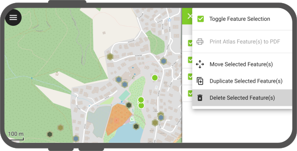
Objekte Löschen
Feldarbeit
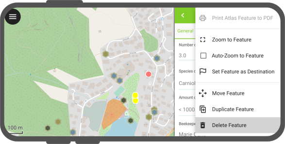
Deleting a feature is done by selecting the Delete feature action in the feature form's (⋮) menu.
QField also allows you to delete multiple features at a time. To do so, first identify the features by short tapping on the relevant parts of the map. Then activate the multi-selection mode by long pressing on one of the features you want to delete. When checkbox appears next to the feature names, select further features to delete (you can tap on the map to add more features too). Once done, select the "Delete Selected Feature(s): action in the features list (⋮) menu.
Objektfang
Vorbereitung am Schreibtisch
Während dem Digitalisieren von neuen Objekten können Punkte von bestehenden Geometrien gefangen werden.
All configuration can be done in Project > Snapping Settings
Objektfangtypen
It is possible to snap new points:
- nur auf Knotenpunkte bestehender Geometrien
- nur auf Segmente bestehender Geometrien
- auf Knoten und Segmente bestehender Geometrien
Objektfang an Layern
Es ist auch möglich, nur auf einen oder wenige Layer zu fangen.
Toleranz für Objektfang
Die Toleranz für den Objektfang kann in Karteneinheiten oder Pixel angegeben werden.
In almost any case, the units should be set to pixels. We made good experiences with a tolerance value of 20.
In einem bekannten Winkel fangen
The Snap to Common Angle feature enhances the precision and efficiency of digitizing geometries by allowing to snap to predefined common angles: 10°, 15°, 30°, 45°, and 90°. This functionality is similar to the advanced digitizing tool in QGIS.
To activate Snap to Common Angle, open the geometry editor and tap on the Snap to Common Angle icon in the toolbar to bring up a menu of common angles. Choose the desired angle from the menu. Then, start digitizing your geometry or adding vertices, and the functionality will automatically align your input to the selected angle. QField will remember the angle relative to the last segment situation for consistent snapping behaviour during subsequent edits.