XLSForm Converter Plugin for QGIS
The XLSForm Converter plugin converts existing XLSForm spreadsheets into fully configured QGIS project files and GeoPackage databases. It migrates survey question structures, logic, and choice lists directly into QGIS layer attribute forms. When installed alongside QFieldSync, the plugin allows uploading converted projects directly to QFieldCloud for mobile field deployment.
XLSForms
XLSForm is a digital form standard used by field survey platforms such as ODK and KoboToolbox.
XLSForm uses Excel spreadsheets (.xlsx, .xls, or .ods) to define survey questions, logic, and choice lists across standard data types (such as integers, text, select lists, and geometries).
Read more on the official XLSForm Reference Website.
Installing the Plugin
Vorbereitung am Schreibtisch
Install the XLSForm Converter plugin using the QGIS Plugin Manager.
Workflow
- In QGIS, navigate to Plugins > Manage and Install Plugins....
- Select the All tab and search for XLSForm Converter.
- Click Install Plugin.
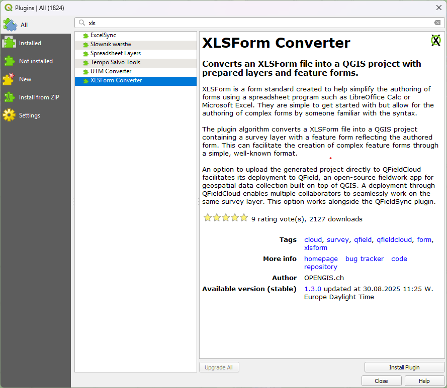
Once installed, the Convert XLSForm to QGIS project algorithm appears in the QGIS Processing Toolbox under the XLSForm group.

Convert XLSForms to QGIS Projects
Vorbereitung am Schreibtisch
Convert an XLSForm spreadsheet into a QGIS project file (.qgz) and GeoPackage database.
Refer to this Google Sheets Template for standard XLSForm structures.
Workflow
- Open the Processing Toolbox in QGIS (Processing > Toolbox).
- Double-click Convert XLSForm to QGIS project under the XLSForm group.
- Select your XLSForm spreadsheet file (
.xls,.xlsx, or.ods). - (Optional) Enter a custom project name and target language.

Workflow
- Select a basemap layer (such as OpenStreetMap or Humanitarian OpenStreetMap Team).
- (Optional) Enable Create QFieldCloud project to automatically create a QFieldCloud project using QFieldSync.
- (Optional) Configure settings under Advanced Parameters:
- Set custom project spatial extents.
- Set target Coordinate Reference Systems (CRS) (defaults to
EPSG:3857 - WGS 84 / Pseudo-Mercator). - Enable Pre-fill project with features' geometries and matching attributes to import existing feature datasets matching XLSForm table schemas.
- Specify the output folder path under Project folder.
- Click Run.
Upon completion, the plugin saves the generated .qgz project file and GeoPackage dataset in the specified directory.
Additional Resources
For technical details and plugin documentation, refer to the following resources: