Standalone Datasets
QField can open vector, raster, and point cloud datasets directly without requiring a QGIS project file.
Supported Standalone Dataset Formats
Supported vector dataset formats:
- GeoPackage (
.gpkg) - GeoJSON (
.geojson,.json) - KML / KMZ (
.kml,.kmz) - ESRI Shapefile (
.shp) - GPS Exchange Format (
.gpx) - Geography Markup Language (
.gml) - MapInfo Interchange Format (
.mif) - SpatiaLite Database (
.db,.sqlite) - FlatGeobuf (
.fgb)
Supported raster dataset formats:
- GeoTIFF (
.tif,.tiff) - Geospatial PDF (
.pdf) - JPEG 2000 (
.jp2) - JPEG (
.jpg,.jpeg) - PNG (
.png) - WebP (
.webp) - Virtual Raster Header (
.vrt)
Supported point cloud dataset formats:
- LAS / LAZ (
.las,.laz) - Cloud Optimized Point Cloud (
.copc.laz,.copc.las)
Note
QField opens compressed ZIP archives containing multiple standalone datasets, adding each file as an individual map layer.
Opening Vector or Raster Datasets
QField界面
Refer to the Storage Access Documentation for instructions on transferring and opening standalone files on mobile devices.
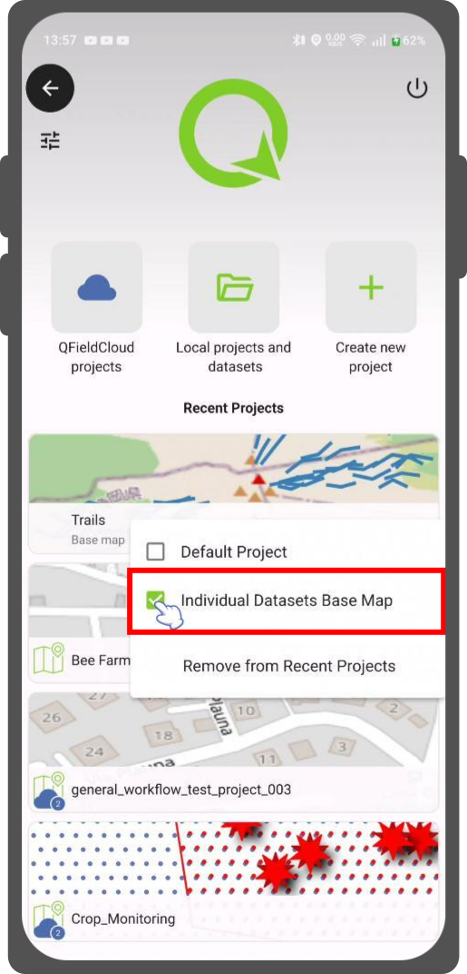
Using a Project as a Base Map for Standalone Datasets
QField界面
Standalone datasets display over a default OpenStreetMap XYZ tile layer. Set any QGIS project stored on your mobile device as a custom background base map.
Workflow
- Open QField and navigate to the project selection screen.
- Long-press the QGIS project file you want to use as a base map.
- Select Use as Base Map in the context menu.