地図の操作
ここでは、QFieldで可能な地図とのインタラクションのいくつかを紹介します。
地図の凡例
フィールドマーク
Open the side "Dashboard" and expand the layers list to display the legend of the map.
レイヤーをダブルタップまたは長押しすると、以下の操作メニューが表示されます。
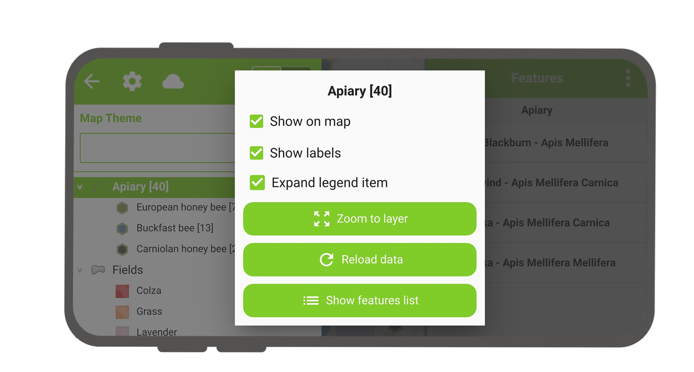
- 凡例アイテムを展開を使用し、レイヤーのサブアイテムの表示/非表示を切り替えます。
- 地図に表示で表示非表示をコントロール。
- ラベルを表示でラベルの表示非表示をコントロール
- Opacity Slider to control the transparency of the layer.
- レイヤーにズームすると、すべてのレイヤーアイテムが地図上に表示されます。
- Reload icon to get the current data of a layer with remote sources.
- 地物の一覧を表示はすべてのレイヤーの地物を識別リストに表示します。
- Setup tracking to set up tracking mode of layer.
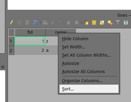
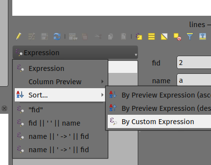
レイヤの地物をソートする
デスクトップの準備
If you'd like to configure the order of features in "Show feature list" in QField, you have the following options to pre-configure this on QGIS:
- Simply right-click on any part of a column header and select the "Sort" option from the menu. This allows you to enter complex sorting expressions for your features as required.
- When being in the form view, you can access the sorting functionality by clicking on the expression button located at the top of the features list and select the "Sort" option.
属性情報の表示
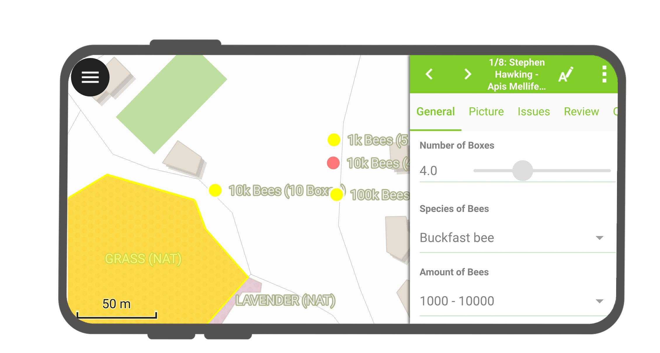
フィールドマーク
Tap on a feature on the map to identify it. If several features are located where you tapped (either because there are multiple features really close one to another, or because several layers are overlapping), they will all be listed in the menu that opens on the right of the screen.
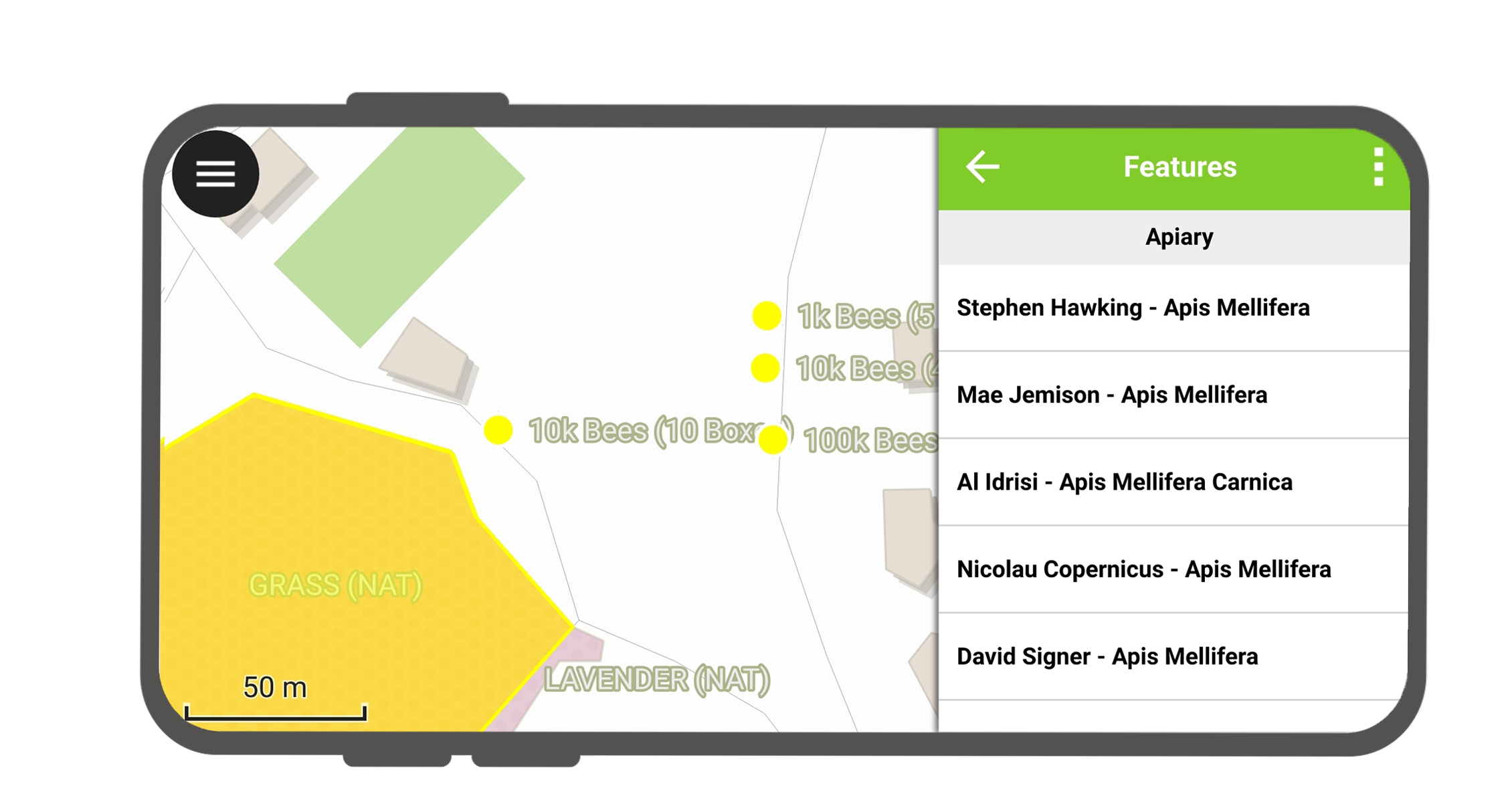
リストアップされた地物の一つをタップして属性情報を表示できます。
- 矢印 をタップして全ての地物の属性情報をスクロールできます。
- 中央表示ボタンをタップして選択している地物を中央に表示できます。
- Tap the edit button to edit the attributes of the selected feature.
- サブメニューをスクロールして、すべての属性にアクセスできます。
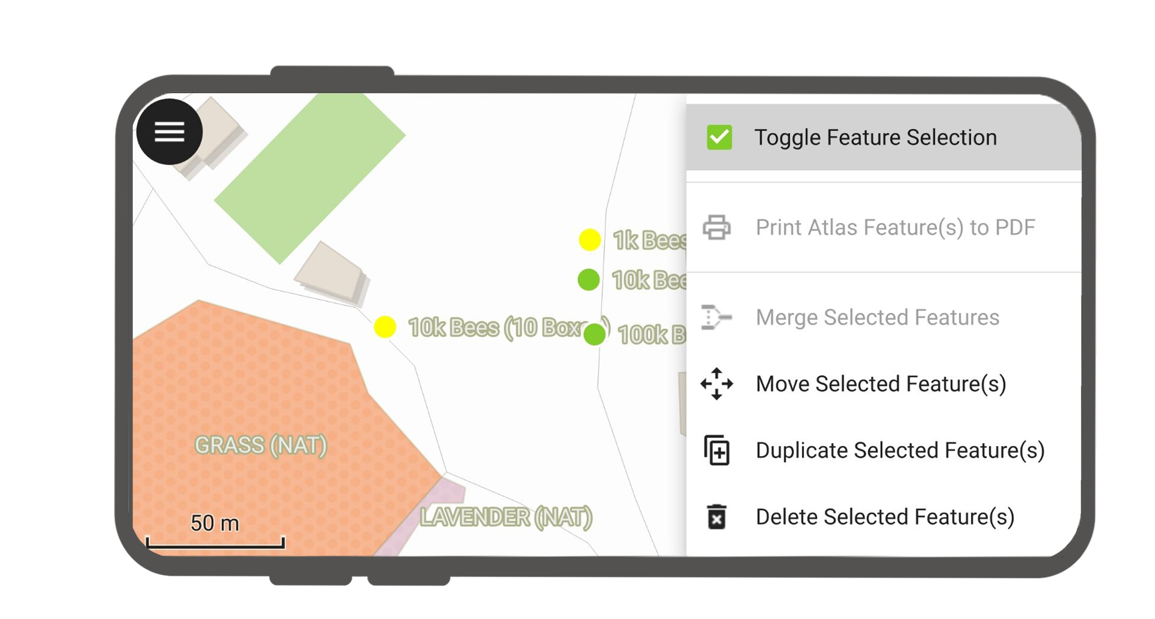
地物を選択する
長押しして地物選択を切り替えられます。
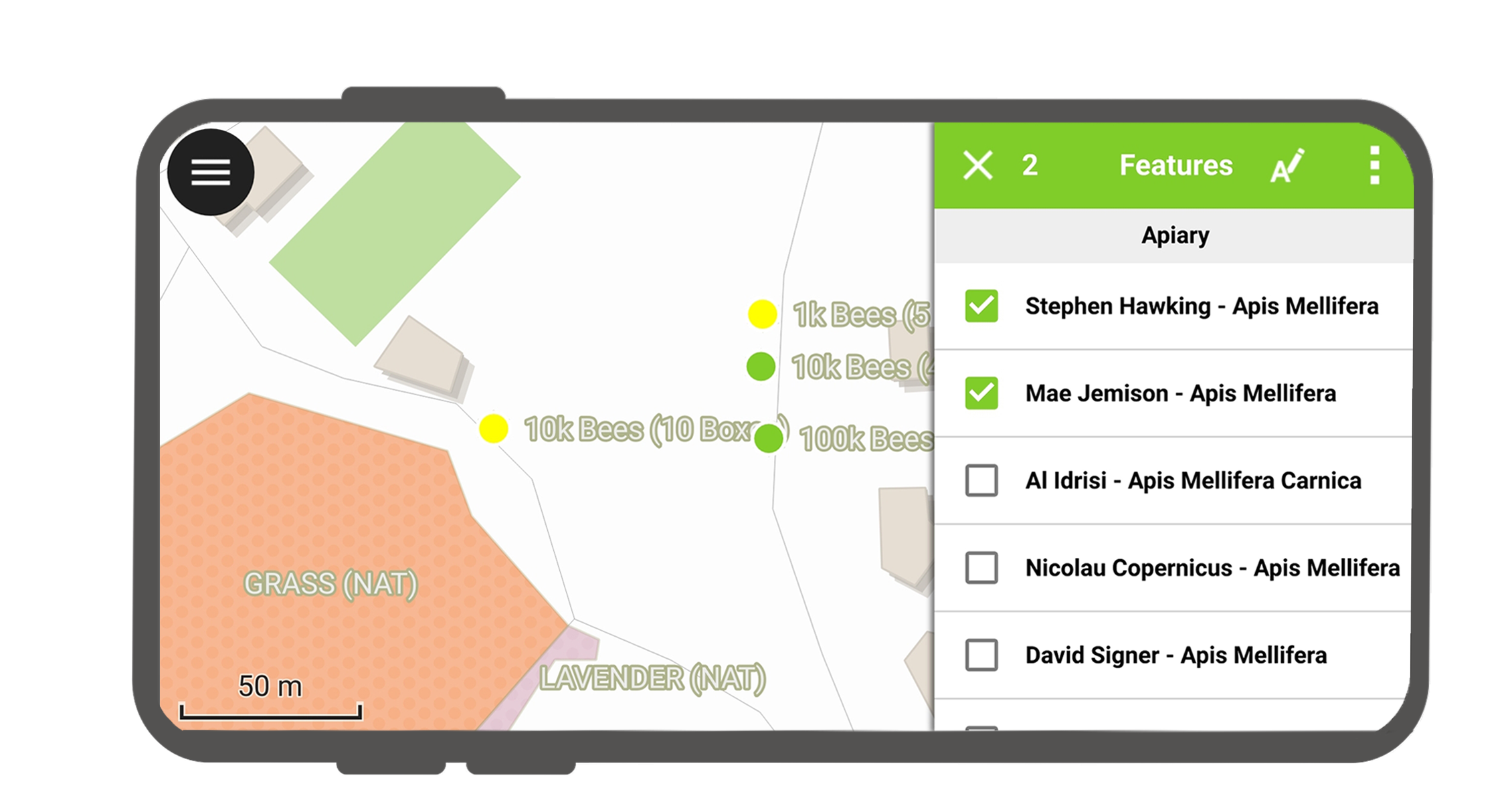
地物が選択されると、右上の三点メニューからアクションを実行できます。
特定レイヤーを属性情報表示から除外する
全てのレイヤーが属性情報を表示する必要があるとは限りません。例えばベースマップとして表示されているレイヤーなどは属性情報の表示は不要です。
You can manage this layer list in QGIS desktop in Project > Properties... > Data sources > Identify Layers and uncheck the base layers.