Search Bar
The QField search bar allows you to:
- Search for features within project vector layers.
- Navigate to specified coordinates.
- Locate spatial bookmarks.
- Evaluate QGIS expressions.
Layer Search
Maastotyö
Search for features across all project layers or restrict searches to the active layer. Filter queries down to specific attribute fields.
Workflow
- Tap the Search button in the top-right corner of the map canvas to expand the search bar.
- Enter your search query into the search bar.
Vector Layers Search
QField uses entered text values to find features with matching attribute values. A minimum of three characters is required to initiate a search query.
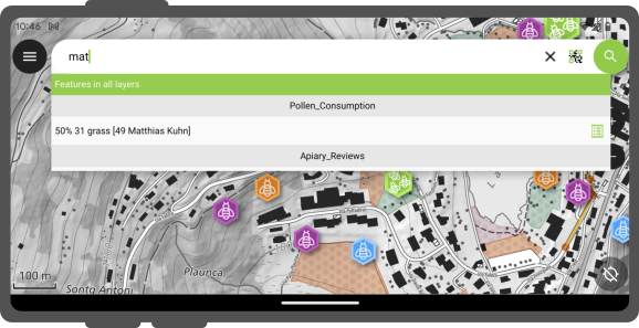
Active Layer Search Feature Matching
Active layer searches focus queries exclusively on the currently active layer and its attributes.
- Search all active layer attributes: Type
ffollowed by your search term (such asf oak). - Target a specific attribute field: Type
f @ATTRIBUTE_NAME search-term(such asf @tree_type oak).
Matching attribute names and values are highlighted in the search results list.

Active layer searches focus queries exclusively on the currently active layer and its attributes.
- Search all active layer attributes: Type
ffollowed by your search term (such asf oak). - Target a specific attribute field: Type
f @ATTRIBUTE_NAME search-term(such asf @tree_type oak).
Matching attribute names and values are highlighted in the search results list.
Workflow
- Tap Scan code inside the search bar to open the Code Reader interface.
- Scan or decode a code using one of two methods:
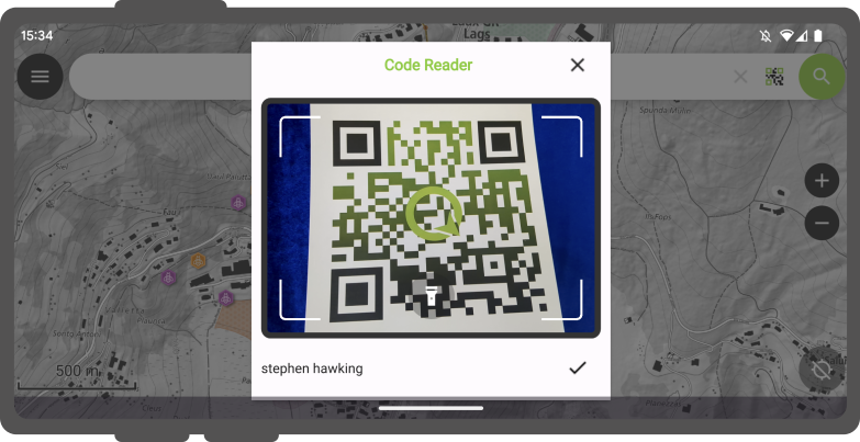
- Live Camera / NFC: Point the camera at a physical QR code or barcode, or hold an NFC text tag near the mobile device.
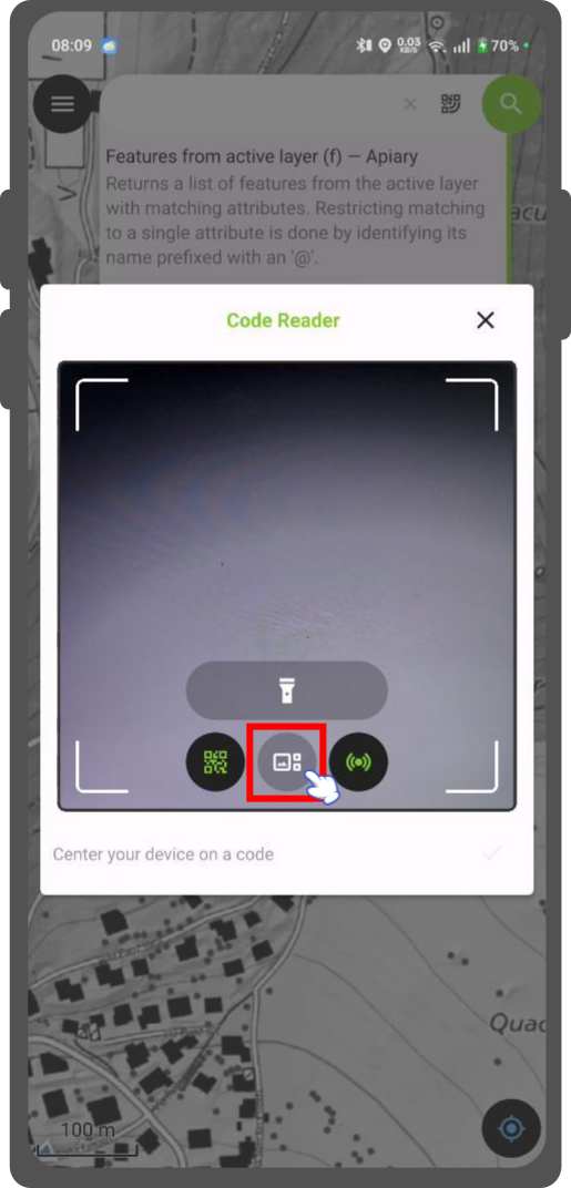
- Image File from Gallery: Tap the Gallery icon on the bottom control bar and select a photo containing a QR code or barcode.
- Live Camera / NFC: Point the camera at a physical QR code or barcode, or hold an NFC text tag near the mobile device.
- Tap the checkmark (✔) button after decoding a code to execute the search query.
Search with Code Scanner
Use the QField Code Reader to search for features by scanning physical codes or selecting stored images.
Workflow
- Tap Scan code inside the search bar to open the Code Reader interface.
- Scan or decode a code using one of two methods:
- Live Camera / NFC: Point the camera at a physical QR code or barcode, or hold an NFC text tag near the mobile device.
- Image File from Gallery: Tap the Gallery icon on the bottom control bar and select a photo containing a QR code or barcode.
- Live Camera / NFC: Point the camera at a physical QR code or barcode, or hold an NFC text tag near the mobile device.
- Tap the checkmark (✔) button after decoding a code to execute the search query.
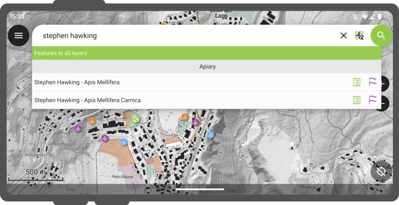
Matching features display in the results list:
- Tap a feature name to pan and highlight the feature on the map canvas.
- Tap the attributes icon to open the feature attribute form directly.
Etsi NFC:n avulla
The Code Reader automatically detects and decodes NFC text tags.
Note
The camera reader and NFC detector are active by default when opening the Code Reader. Toggle either sensor off inside the scanner interface to conserve battery power.
Go to Coordinate
Navigate directly to coordinates using the search bar.
Workflow
- Enter coordinates into the search bar in
Latitude, Longitudeformat (WGS84) or coordinates matching the project CRS. - Tap the coordinate result in the search list. QField automatically centers the map canvas on the specified location.
Go to Spatial Bookmark
Locate and navigate to spatial bookmarks.
Workflow
- Type
binto the search bar to filter for spatial bookmarks. - Enter the name of your bookmark.
- Tap the target bookmark result. QField automatically pans and zooms the map canvas to the saved bookmark extent.
Expression Calculator
The search bar functions as a QGIS expression calculator.
Workflow
- Prefix your query with
=to evaluate expressions (such as= 20 + 5or= $area). - Tap the calculated result in the list to copy the value to the clipboard.
Tip
Use the aggregate() expression function to calculate statistics across vector layers.
For example, calculate the total area of a polygon layer by typing = aggregate('my_layer', 'sum', $area).
Configure Vector Layers Search in QGIS
Project Manager
All vector layers are searchable by default. Exclude specific layers from search queries in QGIS project properties.
Workflow
- Open your project in QGIS.
- Navigate to Project > Properties... > Data Sources.
- Uncheck Searchable in the layer capabilities table for layers you want to exclude.
Read more in the Data Source Configuration guide.