地図の操作
There is a lot you can do inside QField. There exists a number of buttons, icons and settings, which may or may not be relevant for your use case.
Modes
It is important to understand that there are two modes in which you can work
- The Browse mode and
- The Digitize Mode
Browse mode
As the name suggests, while being in browse mode, you can view and select features within all identifiable layers in the project. It is also possible to edit attributes of existing features, by clicking on a feature of interest and opening its attribute table.
Digitize mode
If you want to actually digitize new objects or modify the geometry of existing ones, you have to switch to digitize mode.
Workflow
- Open the Side Dashboard
- At the bottom right of the legend, tap on the to start editing.
- On the bottom right of the map canvas, a will indicate that you can add new features.
You will add new features to the layer that is highlighted in green of your legend.

Note
- You can only edit a feature's geometry if you are in Digitize Mode
- QField ensures that when you digitize that your added points, lines or polygons will not have duplicate vertices.
地図の凡例
Workflow
- Open the Side Dashboard and expand the layers list to display the legend of the map.
-
Long-press or double-tap on a layer
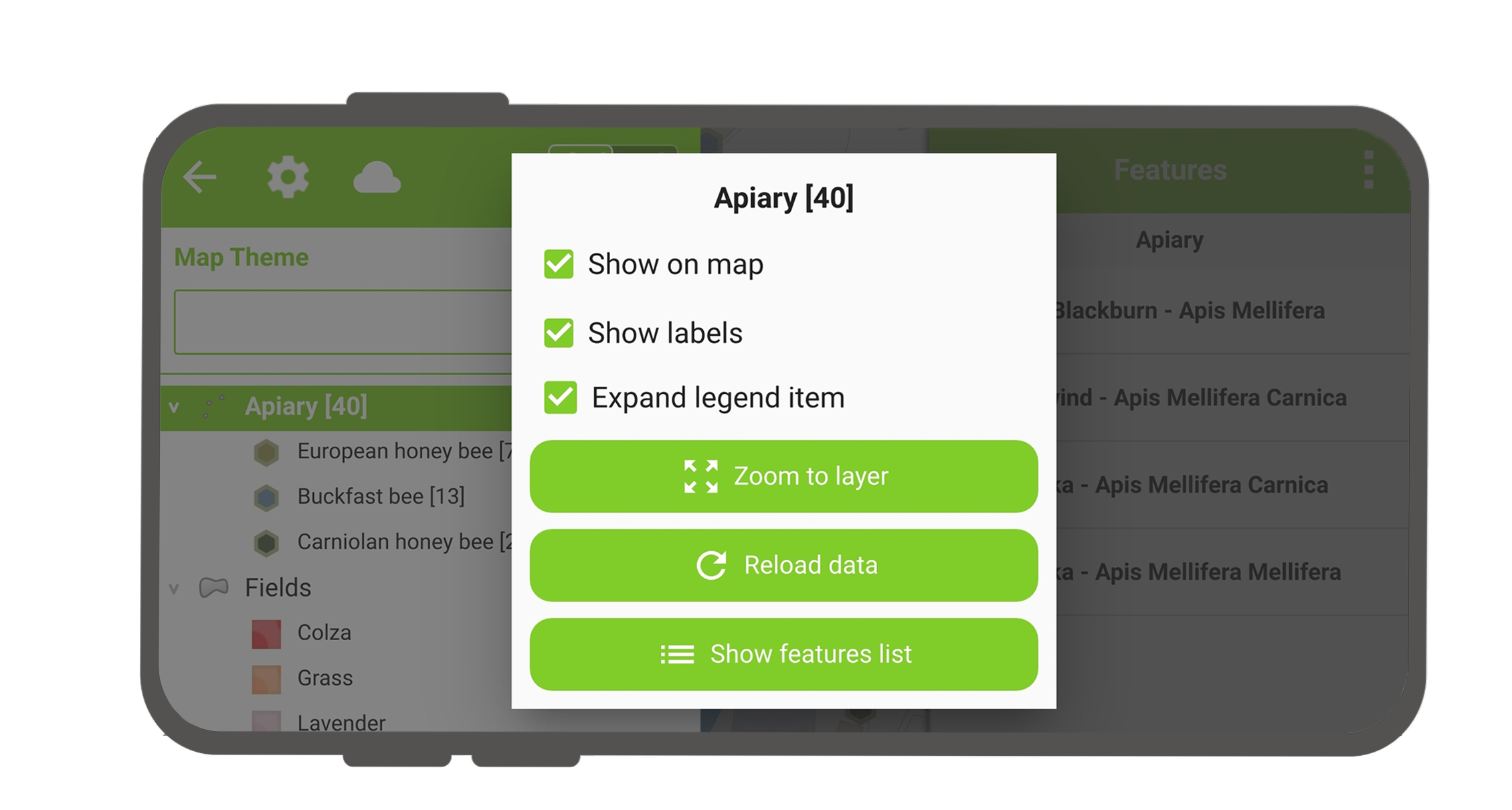
- Reload icon to get the current data of a layer with remote sources.
- Show on map to control visibility.
- Show labels to control the visibility of the labels.
- Opacity Slider to control the transparency of the layer.
- Zoom to layer to have all the layer items on the map.
- Show feature list to show all the layer's features in the identification list.
- Setup tracking to set up tracking mode of layer.
マップテーマ
Workflow
- Open the Side Dashboard.
- If Map themes have been set in your QGIS project, a Dropdown will automatically appear where you can choose the active theme.
Select features
If you want to select an existing feature you can do this in several ways but the easiest is while being in browse mode.
Workflow
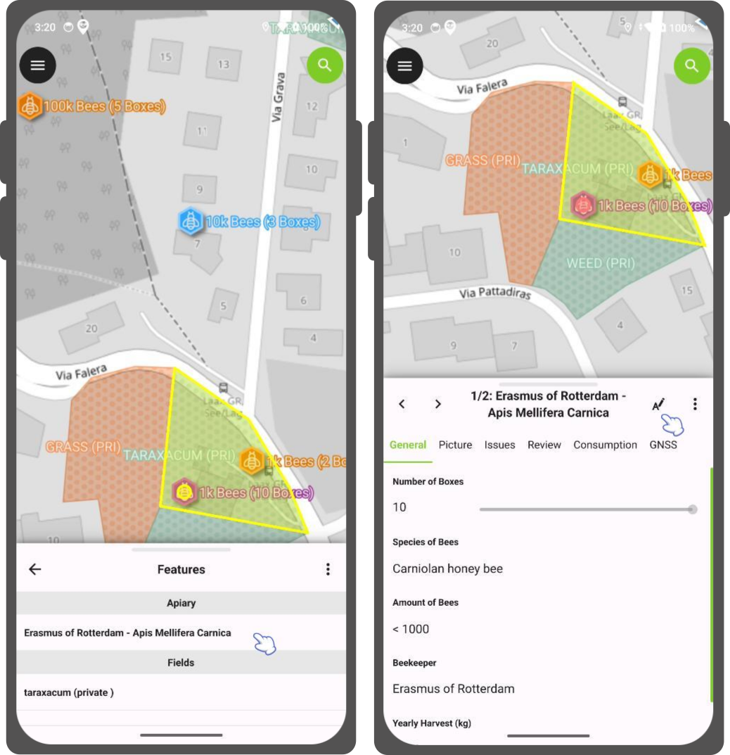
- Tap on a feature on the map to identify it.
If several features are located where you tapped (either because there are multiple features really close one to another, or because several layers are overlapping), they will all be listed in the menu that opens on the right of the screen.
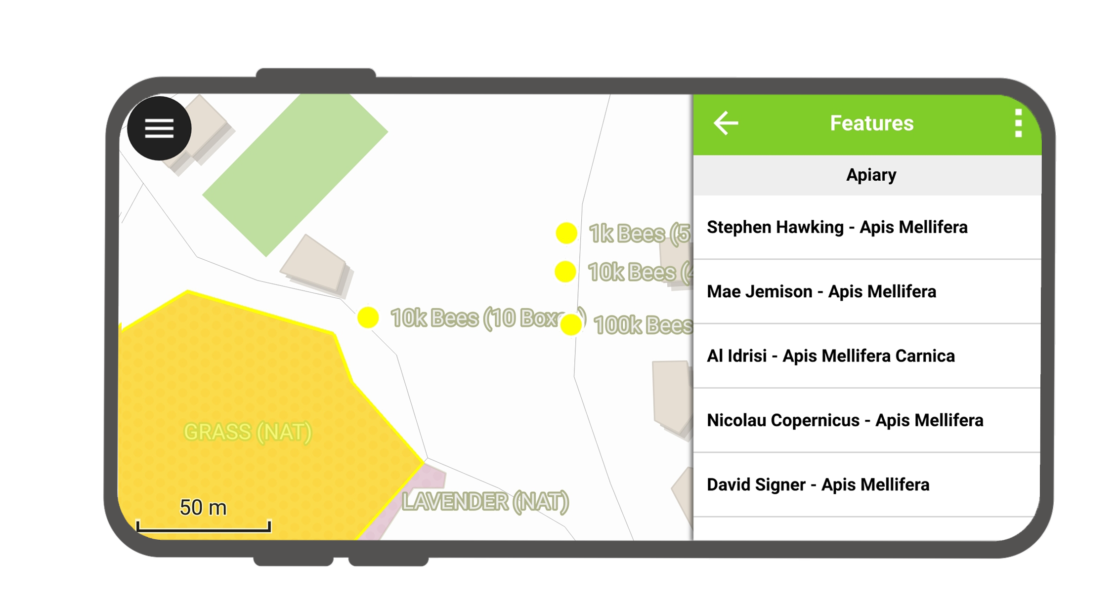
- Tap on one of the listed features to select the feature and open its attributes.
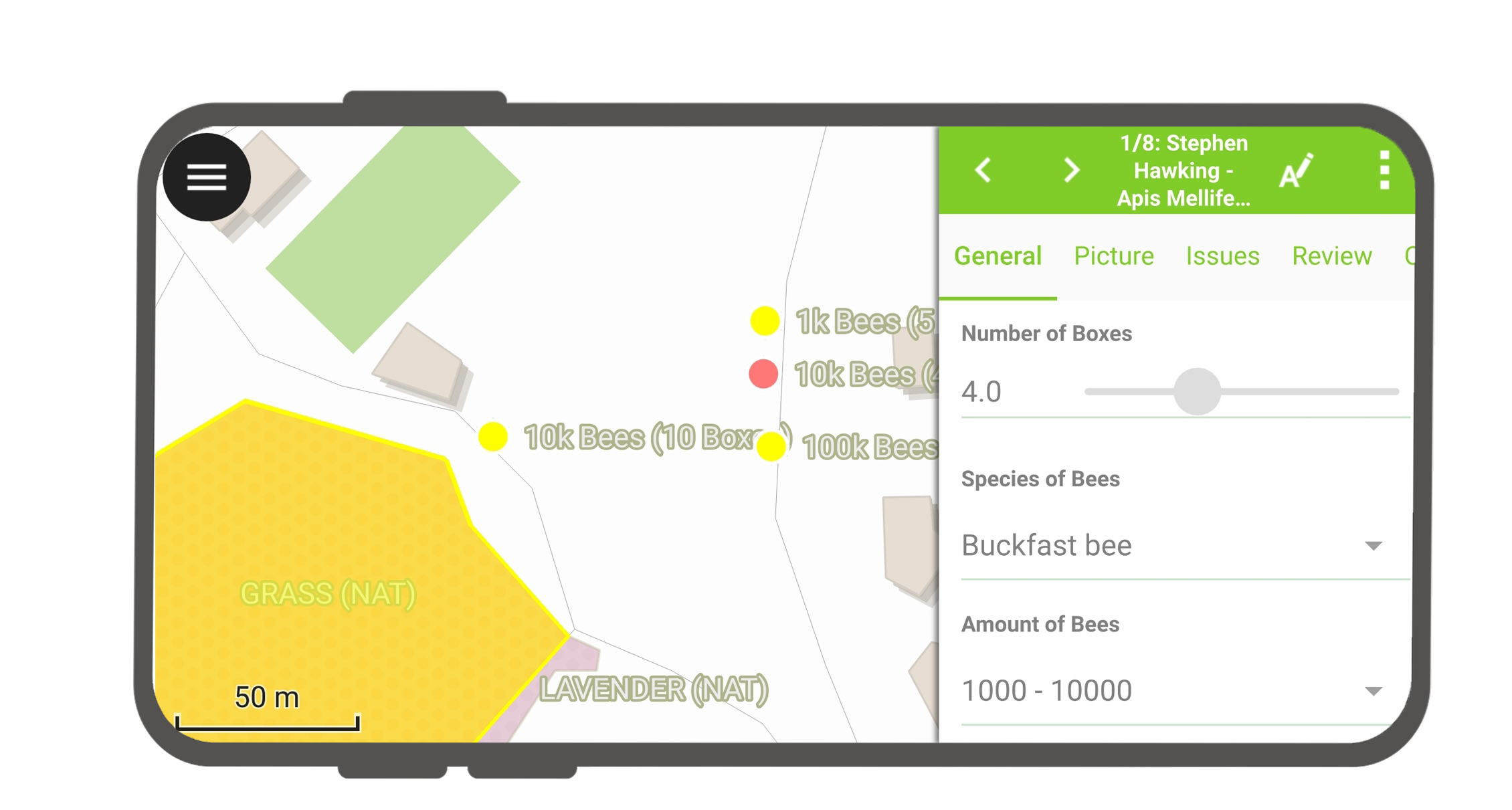
- Once selected you can do several things:
- Tap on the Arrows to switch between all the identified features.
- Tap on the Edit Button (A with the pen) to edit the attributes of the selected feature.
- Tap on the 3-dotted menu from where you can:
- Zoom to the Feature
- Enable Auto-Zoom to the selected feature
- Process the feature further.
- Move the feature
- Duplicate the feature
- Rotate the feature
- Update Attributes from feature - this allows you to copy the attributes from another feature, which you have to select.
- Delete the feature
Multi-select features
Sometimes you may want to multi-select several features at once to merge them or edit their attributes at the same time.
Workflow
- Switch to Browse Mode
- Tap on one or more features at once and long-press on the features you want to select.
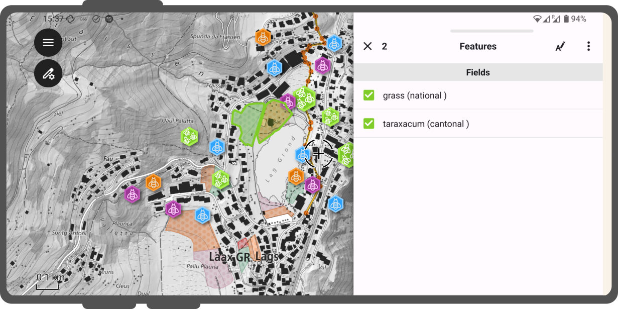
Multi-selected polygons - Tap on the 3-dotted menu on the top right of the feature list.
- From there you can select between multiple options:
- Toggle Feature Selection
- Print Atlas Feature(s) to PDFs: You can print a PDF of your selected features either with the in-built default template or with a pre-defined one which was built by your Project Manager.
- Merge your selected features
- Move your selected features
- Duplicate your selected features
- Delete your selected features
- Further Process your selected features: You can read more about the different processing operations here
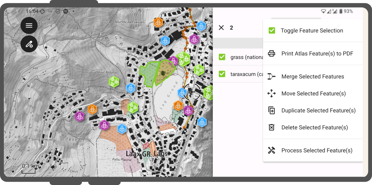
Multi-selected actions
Scale bar
Workflow
- Open your project in QField.
- Open the Side Dashboard.
- Tap on the 3-dotted menu and open Settings.
- Under the General tab enable Show scale bar.
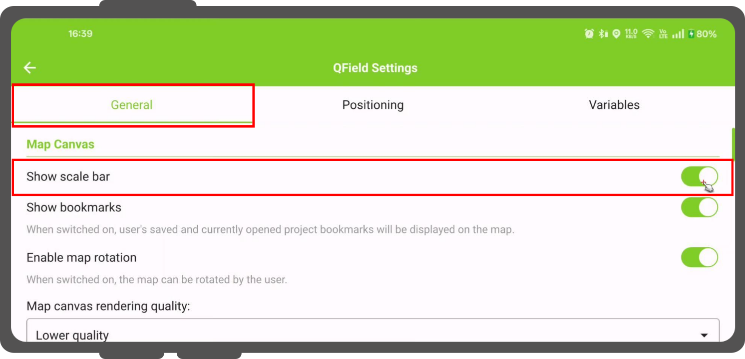
3D map view interactions
QField supports viewing and interacting with your project data in a 3D map view. By utilizing elevation data (either an automatic online DEM or a custom DEM configured in your QGIS project), your map layers are draped as textures over the 3D surface. You can interactively navigate your map in 3D and seamlessly synchronize extents with the 2D canvas.