センサー
QField supports background sensor logging, allowing you to passively collect sensor data, display live measurements on the map canvas, and store readings inside feature attribute fields.
Activating Sensors
フィールドマーク
You can toggle and manage registered sensors from under your project settings.
Workflow
- Open the Side Dashboard.
- Tap the three-dotted menu (⋮) and select Sensors.
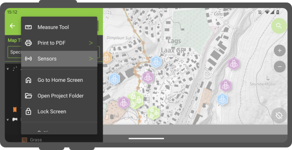
- Tap a sensor name in the submenu to toggle data collection. When active, a sensor icon displays next to the sensor name; when inactive, a dot icon displays.
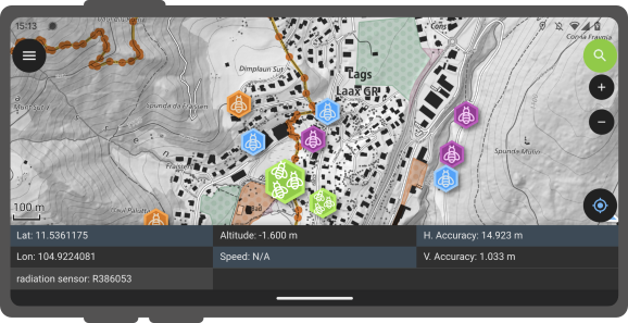
Active sensors collecting data display live readings inside a sensor information panel at the bottom of the map canvas.
センサードリブンな追跡機能

You can also store live sensor readings linked to GNSS positions by initiating tracking sessions on point vector layers.
Configuration in QGIS
デスクトップの準備
Workflow
- In QGIS, open Vector Layer Properties... > Attribute Form for your target point layer.
- Select the attribute field intended to store sensor readings.
- Set Default Value to
sensor_data('sensor_name')(replace'sensor_name'with your target sensor identifier). Read more on default values here.
Running Sensor-Driven Tracking
フィールドマーク
Workflow
- Open your project in QField and initiate a tracking session on the configured point layer.
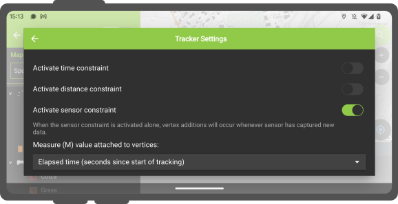
- (Optional) Enable the sensor constraint toggle when configuring the tracking session to record a new point feature each time the sensor captures new data.